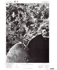
1975 Map of Prouts Neck
USGS Topo · Published 1979About this map
The coastal marshlands and rocky peninsulas of Cumberland County are captured in this orthophotograph, where the Dunstan River and Nonesuch River wind through the expansive salt marshes of Scarborough. This aerial perspective highlights the distinct transition between the developed residential areas of South Portland and the jagged shoreline extending toward Prouts Neck. The 1970s landscape shows the established beach communities of Higgins Beach and Blue Point before further modern expansion. By utilizing an aerial photograph from April 30, 1975, the map provides a clear view of the sediment patterns in Saco Bay and the detailed street grids of Old Orchard Beach, offering a precise record of the shoreline and maritime geography during this era.
Find a feature on this map
10 named features on this map. Tap any name to fly to it.
Don’t see what you’re looking for? This feature index may not catch every label — zoom into the map to look around manually.
Map Details
Editions of this 1975 Prouts Neck Map
This is the sole edition of this map. No revisions or reprints were ever made.
Other maps of this area

1891 · Portland
USGS Topo · 1:62,500

1891 · Biddeford
USGS Topo · 1:62,500

1893 · Biddeford
USGS Topo · 1:62,500

1893 · Portland
USGS Topo · 1:62,500

1893 · Casco Bay
USGS Topo · 1:62,500

1914 · Portland
USGS Topo · 1:48,000

1914 · Casco Bay
USGS Topo · 1:48,000

1916 · Portland
USGS Topo · 1:62,500

1916 · Casco Bay
USGS Topo · 1:62,500

1916 · Portland And Vicinity
USGS Topo · 1:62,500