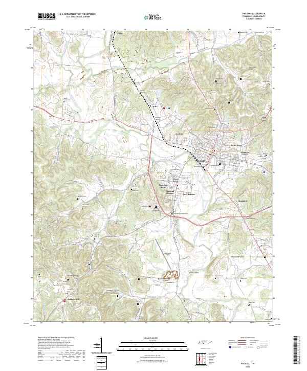
2022 Map of Pulaski
USGS Topo · Published 2022About this map
Pulaski serves as the focal point of this Giles County landscape, where the confluence of Richland Creek and numerous small branches once drove local settlement. The town's historic core is anchored by Martin Methodist College and several significant burial grounds, including the Old Graveyard Memorial Park Cem and Maplewood Cem. Surrounding the city, residential developments such as Rebel Acres, Glendale Estates, and Highland Heights indicate the mid-to-late 20th-century expansion of the community into the nearby hills.
Find a feature on this map
190 named features on this map. Tap any name to fly to it.
Don’t see what you’re looking for? This feature index may not catch every label — zoom into the map to look around manually.
Map Details
Editions of this 2022 Pulaski Map
This is the sole edition of this map. No revisions or reprints were ever made.
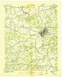
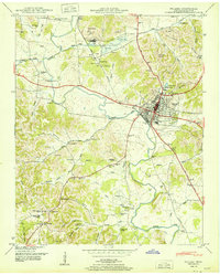
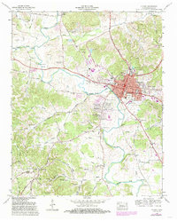
Historical Maps of Anthony Hill Through Time
4 maps found