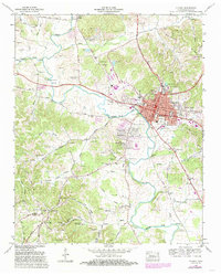
1966 Map of Pulaski
USGS Topo · Published 1986About this map
Pulaski serves as the focal point of this Tennessee Valley Authority study, showing a bustling county seat as its residential footprint expanded into Rebel Acres and Glendale Estates. The local economy of the mid-1960s is evidenced by the numerous strip mines dotting the northern ridges and the presence of the Seaboard Coast Line railroad. Education and community life are anchored by Martin College, the Giles Co High Sch, and landmarks like the Courthouse and Giles County Hospital.
Find a feature on this map
116 named features on this map. Tap any name to fly to it.
Don’t see what you’re looking for? This feature index may not catch every label — zoom into the map to look around manually.
Map Details
Editions of this 1966 Pulaski Map
3 editions found
Other maps of this area

1936 · Milky Way
USGS Topo · 1:24,000

1936 · Aspen Hill
USGS Topo · 1:24,000

1936 · Campbellsville
USGS Topo · 1:24,000

1936 · Brick Church
USGS Topo · 1:24,000

1936 · Pulaski
USGS Topo · 1:24,000

1936 · Bodenham
USGS Topo · 1:24,000

1936 · Appleton
USGS Topo · 1:24,000

1936 · Tarpley
USGS Topo · 1:24,000

1936 · Elkton
USGS Topo · 1:24,000

1946 · Brick Church
USGS Topo · 1:24,000