
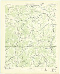
1936 Map of Bodenham
USGS Topo · Published 1936About this map
Bodenham sits at the crossroads of a rural Tennessee landscape defined by winding hollows and small-scale agriculture during the mid-1930s. The Tennessee Valley Authority documented this area along the Lawrence-Giles county line, revealing a dense network of local landmarks like Beechnut Grove Ch and Scott Hill Ch. Education and community life are clearly mapped through scattered facilities such as Westside Sch and Bodenham Sch, which served families tucked into valleys like Fogg Hollow and Johnson Hollow. Modern infrastructure begins to intersect with these traditional settlements as the T E P Co Trans Line and Power Company Trans Line cut across the drainage of Choate Creek, marking the early expansion of electrical utility networks through middle Tennessee’s rural corridors.
Find a feature on this map
54 named features on this map. Tap any name to fly to it.
Don’t see what you’re looking for? This feature index may not catch every label — zoom into the map to look around manually.
Map Details
Editions of this 1936 Bodenham Map
2 editions found
Other maps of this area

1936 · Milky Way
USGS Topo · 1:24,000

1936 · Aspen Hill
USGS Topo · 1:24,000

1936 · Campbellsville
USGS Topo · 1:24,000

1936 · Lawrenceburg
USGS Topo · 1:24,000

1936 · Ethridge
USGS Topo · 1:24,000

1936 · Pulaski
USGS Topo · 1:24,000

1936 · Appleton
USGS Topo · 1:24,000

1936 · Bonnertown
USGS Topo · 1:24,000
1948 · Appleton
USGS Topo · 1:24,000

1948 · Bodenham
USGS Topo · 1:24,000