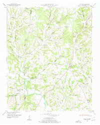
1948 Map of Appleton
USGS Topo · Published 1948About this map
Minor Hill and Appleton anchor this 1948 topographic study of the Tennessee hill country along the Lawrence and Giles County line. The landscape is defined by the winding course of Sugar Creek and the forks of Shoal Creek, where small-scale farming and rural commerce centered around locations like Williams Store and Thorne Store. The presence of the Sam Davis Monument near Wray Branch provides a specific point of local historical interest, marking the geography with cultural significance. Settlement patterns follow the hollows and ridges, with numerous country schools and churches, such as Appleton Sch and Pleasant Ridge Church, serving as the social centers for dispersed homesteads. The map illustrates a pre-modern rural network of fords, including Peach Ford, and winding branches that dictated the movement of goods and people between isolated hollows like Givens Hollow and Coffman Hollow.
Find a feature on this map
96 named features on this map. Tap any name to fly to it.
Don’t see what you’re looking for? This feature index may not catch every label — zoom into the map to look around manually.
Map Details
Editions of this 1948 Appleton Map
This is the sole edition of this map. No revisions or reprints were ever made.
Other maps of this area

1914 · Rogersville
USGS Topo · 1:48,000

1916 · Rogersville
USGS Topo · 1:62,500

1936 · Union Hill
USGS Topo · 1:24,000

1936 · Aspen Hill
USGS Topo · 1:24,000

1936 · Lexington
USGS Topo · 1:24,000

1936 · Lawrenceburg
USGS Topo · 1:24,000

1936 · Pulaski
USGS Topo · 1:24,000

1936 · Bodenham
USGS Topo · 1:24,000

1936 · Appleton
USGS Topo · 1:24,000

1936 · Bonnertown
USGS Topo · 1:24,000