Old Maps of Minor Hill, Tennessee
Explore 41 old maps of Minor Hill, spanning from 1936 to today. These high-resolution historic maps reveal how streets, neighborhoods, landmarks, and natural features evolved over time — perfect for genealogy, metal detecting, research, and local history exploration.
What you can do with these maps:
- See how Minor Hill changed over time: Compare historical maps to modern-day views to trace roads, homesites, rail lines & more.
- View detailed metadata: Each map includes creators, publishers, year, scale, and archive source.
- Overlay maps with satellite & LiDAR: Visualize the past alongside modern tools to explore terrain & human change.
- Trusted historical sources: Maps sourced from the USGS, Library of Congress, and other archives.
- Access maps your way: View online, download high-res files, or order prints for personal or research use.
Start exploring old maps of Minor Hill to uncover forgotten places, hidden landmarks, and the deep history beneath your feet.
Minor Hill, TN maps
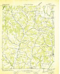
(41)- 1936 Map of Union Hill
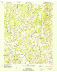
 1936 Union Hill1936 Print · USGSThe Alabama and Tennessee borderlands are captured here in the mid-1930s as modern infrastructure arrived in a landscape of small family farms. Researchers can locate long-standing landmarks like Ridgeways Mill, Hester Cem, and the rural community of Good Springs.
 - 1936 Map of Aspen Hill
 1936 Aspen Hill1936 Print · USGSGiles County at the mid-thirties is a landscape of rural schoolhouses and family-named hollows connected by the Louisville and Nashville Railroad. You can trace the historic footprint of Aspen Hill and find lost landmarks like Tarpleys Store or Beasley Chapel School.
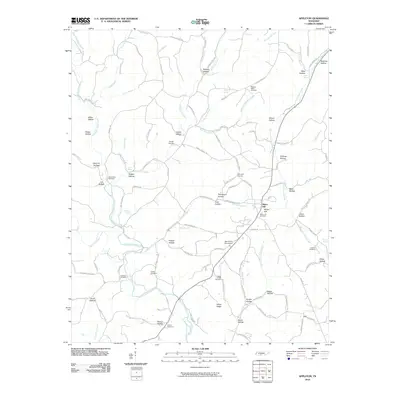
 - 1936 Map of Appleton
 1936 Appleton1936 Print · USGSGiles and Lawrence Counties are captured here in the mid-1930s, showing a rural landscape of creek-side settlements and family homesteads. Researchers can trace ancestral locations through numerous sites like Powell Cem, Appleton Sch, and Minor Hill.
 - 1936 Map of Salem
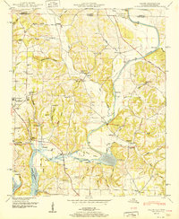
 1936 Salem1936 Print · USGSNorthern Alabama in the mid-thirties shows a landscape being reshaped by the rising waters of Wheeler Reservoir. Genealogists can trace early homesteads and family sites like Conniegun Cem and Walnut Grove Ch.
 - 1948 Map of Appleton
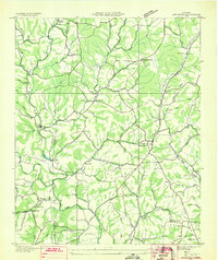
 1948 Appleton1948 Print · USGSThe rural borderlands of Giles and Lawrence Counties come alive in the late 1940s, showing a landscape of ridge-top farms and creek-side stores. Genealogists can locate family landmarks like Oxford Cem, the Sam Davis Monument, and the Liberty Hill Sch.
 - 1948 Map of Union Hill, 1973 Print
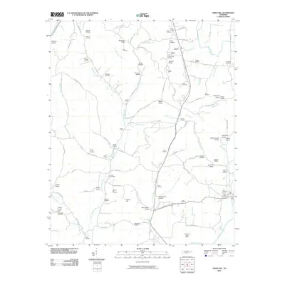
 1948 Union Hill1973 Print · USGSThe Alabama-Tennessee borderlands appear here in the mid-twentieth century as a landscape of small farming hamlets and creek-side industry. Researchers can locate family landmarks like Ridgway Mill, Hester Chapel, and the McCraw Cem along the banks of Sugar Creek.
 - 1948 Map of Salem, 1974 Print
 1948 Salem1974 Print · USGSThe Alabama-Tennessee borderlands appear here in the late 1940s, showing a river-valley landscape being reshaped by the Wheeler Reservoir. Researchers can trace old family footprints at Leggtown, Gourdsville, and the ELK RIVER FISH HATCHERY, alongside numerous rural burial sites like Nelson Cem.
 - 1948 Map of Aspen Hill, 1974 Print
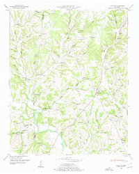
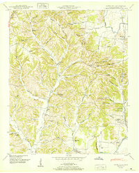
 1948 Aspen Hill1974 Print · USGSGiles County at the edge of northern Alabama was a landscape of ridge-top schools and creek-bottom rail stops just after the war. Family researchers can locate Cedar Grove School, the Louisville and Nashville line, and Prospect Station.
 - 1950 Map of Appleton
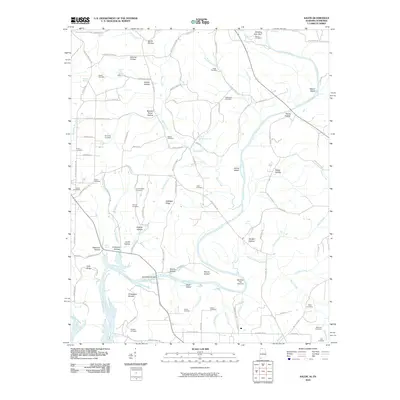
 1950 Appleton1950 Print · USGSGiles County in the late 1940s is captured here as a network of creek-side communities and family homesteads. Genealogists and local historians can trace legacy sites like the Sam Davis Monument, Minor Hill, and schools including Appleton Sch and Puncheon Sch.3 unique versions available
 - 1950 Map of Aspen Hill
 1950 Aspen Hill1950 Print · USGSGiles County at mid-century reveals a landscape of high ridges and deep hollows connected by the Louisville and Nashville railroad. You can trace early family roots through dozens of local identifiers like Davis Academy, Hanna Ch, and Mt Carmel Cem.3 unique versions available
 - 1951 Map of Union Hill
 1951 Union Hill1951 Print · USGSThe Alabama-Tennessee state line runs through this mid-century rural landscape, marked by family farms and the rising influence of the Tennessee Valley Authority. Researchers can trace the legacy of early settlements like Lester and Union Hill or locate old community hubs like Ridgway Mill and Rockaway Sch.2 unique versions available
 - 1951 Map of Salem
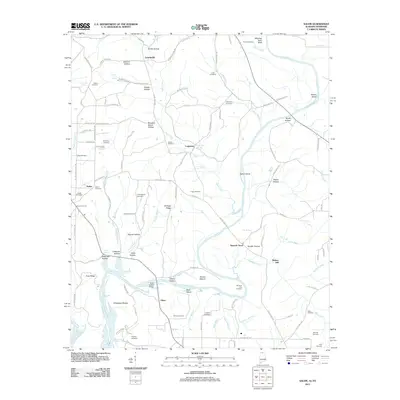
 1951 Salem1951 Print · USGSLimestone County life is captured here in the early fifties as the Elk River meets the Wheeler Reservoir. Genealogists and local historians can trace family landmarks like Browning Cem, the community of Salem, and the Elk River Fish Hatchery.3 unique versions available
 - 1956 Map of Columbia, 1960 Print
 1956 Columbia1960 Print · USGSMiddle Tennessee in the mid-fifties presents a landscape of established river towns and critical rail hubs before the arrival of the modern interstate system. Researchers can trace the routes of the Louisville and Nashville railroad or locate historic landmarks like Stones River National Military Park and the Tennessee National Wildlife Refuge.6 unique versions available
 - 1956 Map of Gadsden, 1966 Print
 1956 Gadsden1966 Print · USGSNorth Alabama in the mid-1950s shows a region transformed by river engineering and federal industry. Genealogists and local historians can trace the development of the Tennessee Valley through the growth of Huntsville, the sprawling Redstone Arsenal, and the expansive Guntersville Lake.3 unique versions available
 - 1958 Map of Gadsden
 1958 Gadsden1958 Print · USGSNorth Alabama comes alive in the late 1950s as the Tennessee Valley Authority’s massive river projects and the rise of the space industry reshaped the landscape. Researchers can trace the mid-century footprints of Huntsville, Redstone Arsenal, and the riverside rail networks of the Southern railroad.
 - 1960 Map of Gadsden
 1960 Gadsden1960 Print · USGSNorthern Alabama in the mid-1950s is defined by the mighty Tennessee River and its massive reservoirs. Trace the development of Huntsville and Redstone Arsenal or explore the vast William B Bankhead National Forest.2 unique versions available
 - 1963 Map of Gadsden
 1963 Gadsden1963 Print · USGSNorthern Alabama underwent a dramatic mid-century transformation as the Tennessee Valley became a hub for defense and industry. Researchers can trace the development of the Redstone Arsenal, the route of the Natchez Trace Parkway, and long-standing rail lines like the Southern Railway.
 - 1985 Map of Lawrenceburg
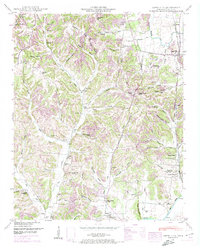
 1985 Lawrenceburg1985 Print · USGSMiddle Tennessee and Northern Alabama are captured in the mid-1980s, showcasing a landscape of high ridges and winding river valleys. Genealogists and historians can trace rail lines like the Seaboard System Railroad or locate community landmarks such as Saint Marys Church and Three Churches.2 unique versions available
 - 1986 Map of Tuscumbia
 1986 Tuscumbia1986 Print · USGSThe Tennessee River valley in the mid-1980s shows a landscape transformed by massive reservoirs and industrial hubs. Genealogists and local historians can trace the development of the Shoals area and locate rural communities like Tharp Town, Leighton, and Rogersville.3 unique versions available
 - 2010 Map of Union Hill, 2010 Print
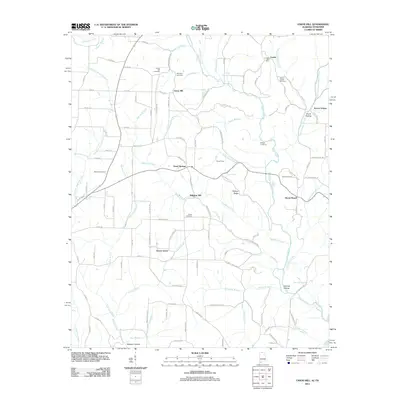
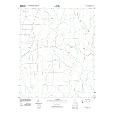 2010 Union Hill2010 Print · USGSCovers Minor Hill, including Lester, Cherry Grove, and other nearby areas
 - 2010 Map of Salem, 2010 Print
 2010 Salem2010 Print · USGSCovers Minor Hill, including Walnut Hill, Salem, and other nearby areas
 - 2010 Map of Aspen Hill, 2010 Print
 2010 Aspen Hill2010 Print · USGSCovers Minor Hill, including Oak Grove, Stella, and other nearby areas
 - 2010 Map of Appleton, 2010 Print
 2010 Appleton2010 Print · USGSCovers Minor Hill, including Sexton, Malone, and other nearby areas
 - 2011 Map of Salem, 2011 Print
 2011 Salem2011 Print · USGSCovers Minor Hill, including Walnut Hill, Salem, and other nearby areas
 - 2011 Map of Union Hill, 2011 Print
 2011 Union Hill2011 Print · USGSCovers Minor Hill, including Lester, Cherry Grove, and other nearby areas
Showing maps 1-25 of 41
Top cities near Minor Hill
- Huntsville historical maps
- Athens historical maps
- Lawrenceburg historical maps
- Pulaski historical maps
- Rogersville historical maps
- Lexington historical maps
See more
Frequently asked questions
- What are the different types of historical maps available for Minor Hill?
- What is the oldest map of Minor Hill?
- Where can I purchase historical maps of Minor Hill for my home or office?
- Where can I download high-res historical maps of Minor Hill?
- Are there historical topographic maps available for Minor Hill?
- Is there historical aerial imagery available for Minor Hill?
- Where are historical maps of Minor Hill sourced from?