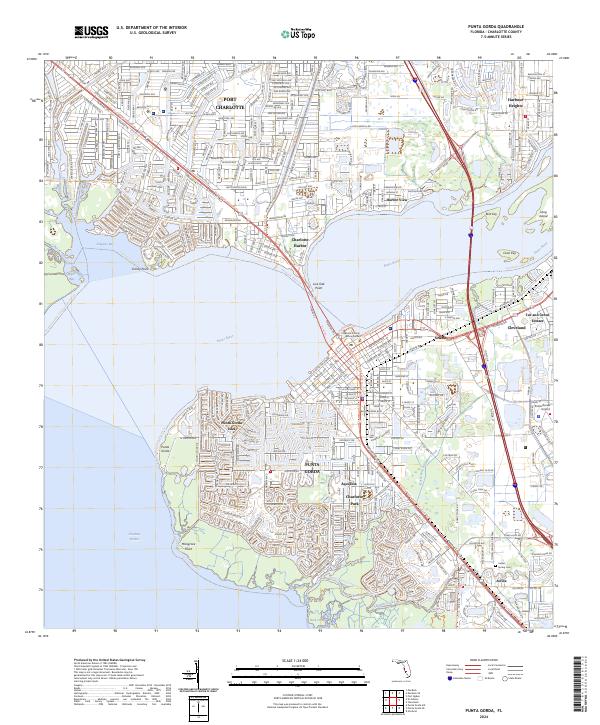
2024 Map of Punta Gorda
USGS Topo · Published 2024About this map
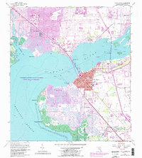
Punta Gorda sits at the confluence of the Peace River and Charlotte Harbor, anchoring a landscape where historical coastal settlements meet modern infrastructure. The map details the dense residential grids of Port Charlotte and Punta Gorda Isles, contrasted by the protected wetlands of the Charlotte Harbor Preserve State Park. Transportation corridors like the Tamiami Trail and US 41 Trail connect these communities to inland hubs like the Punta Gorda Airport. Local history is preserved at sites such as Indian Spring Cemetery near Acline, while the waterfront remains defined by points like Mangrove Point and Live Oak Point. The map illustrates the region's evolution from smaller riverfront outposts like Cleveland and Harbor View into a major Southwest Florida residential and recreational center.
Find a feature on this map
49 named features on this map. Tap any name to fly to it.
Don’t see what you’re looking for? This feature index may not catch every label — zoom into the map to look around manually.
Map Details
Editions of this 2024 Punta Gorda Map
This is the sole edition of this map. No revisions or reprints were ever made.