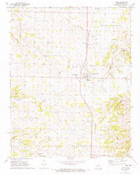
1972 Map of Purdy
USGS Topo · Published 1973About this map
The St Louis - San Francisco railroad anchors the landscape of central Barry County, running through the heart of Purdy and south toward Butterfield. This early 1970s survey captures a rural Missouri crossroads defined by its family cemeteries and numerous country churches, reflecting a long-settled agricultural community. Notable landmarks like the Henderson Cem and St Johns Ch are scattered across King Prairie, while smaller communities such as Corsicana and East Purdy mark the intersections of the local road network.
Find a feature on this map
46 named features on this map. Tap any name to fly to it.
Don’t see what you’re looking for? This feature index may not catch every label — zoom into the map to look around manually.
Map Details
Editions of this 1972 Purdy Map
This is the sole edition of this map. No revisions or reprints were ever made.
Other maps of this area

1937 · Cassville
USGS Topo · 1:48,000

1941 · Rocky Comfort
USGS Topo · 1:62,500

1943 · Ritchey
USGS Topo · 1:62,500

1943 · Monett
USGS Topo · 1:62,500

1943 · Rocky Comfort
USGS Topo · 1:62,500

1944 · Cassville
USGS Topo · 1:62,500

1945 · Harrison
USGS Topo · 1:250,000

1949 · Harrison
USGS Topo · 1:250,000

1954 · Harrison
USGS Topo · 1:250,000

1954 · Tulsa
USGS Topo · 1:250,000