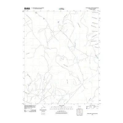
2010 Map of Purgatory Canyon
USGS Topo · Published 2010About this map
Mokie Indian Ruin sits in the northern reaches of this landscape, a significant archaeological marker near Barker Arroyo. The terrain is defined by a dense network of drainages and mesas, including the prominent Barker Dome and the namesake Purgatory Canyon. This era shows a land managed by the Bureau of Indian Affairs, crisscrossed by specialized transport corridors such as Indian Service Route 205 and Indian Service Route 211.
Find a feature on this map
37 named features on this map. Tap any name to fly to it.
Don’t see what you’re looking for? This feature index may not catch every label — zoom into the map to look around manually.
Map Details
Editions of this 2010 Purgatory Canyon Map
This is the sole edition of this map. No revisions or reprints were ever made.
Other maps of this area

1889 · Chaco
USGS Topo · 1:250,000

1892 · Chaco
USGS Topo · 1:250,000

1912 · Soda Canyon
USGS Topo · 1:62,500

1913 · Red Mesa
USGS Topo · 1:62,500

1915 · Soda Canyon
USGS Topo · 1:62,500

1954 · Shiprock
USGS Topo · 1:250,000

1956 · Cortez
USGS Topo · 1:250,000

1958 · Cortez
USGS Topo · 1:250,000

1958 · Shiprock
USGS Topo · 1:250,000

1959 · Shiprock
USGS Topo · 1:250,000