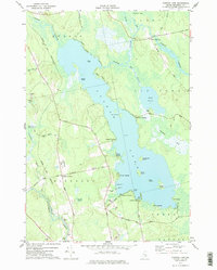
1977 Map of Pushaw Lake
USGS Topo · Published 1977About this map
Pushaw Lake and its intricate shoreline dominate this Penobscot County landscape, reflecting a mid-1970s balance between seasonal recreation and local rural life. The eastern shore is characterized by numerous landings, such as Old Town Landing and Lakeside Landing, while the presence of a Seaplane Base at French Pt underscores the importance of water-based transport in this region. Inland to the west, Glenburn Center serves as a local hub with its Glenburn Sch and Lakeview Cem, connected by a network of rural roads like Lakeview Road and Pushaw Road.
Find a feature on this map
63 named features on this map. Tap any name to fly to it.
Don’t see what you’re looking for? This feature index may not catch every label — zoom into the map to look around manually.
Map Details
Editions of this 1977 Pushaw Lake Map
This is the sole edition of this map. No revisions or reprints were ever made.
Other maps of this area

1902 · Orono
USGS Topo · 1:62,500

1902 · Bangor
USGS Topo · 1:62,500

1917 · Passadumkeag
USGS Topo · 1:62,500

1933 · Boyd Lake
USGS Topo · 1:62,500

1942 · Bangor
USGS Topo · 1:62,500

1944 · Orono
USGS Topo · 1:62,500

1946 · Bangor
USGS Topo · 1:62,500

1946 · Orono
USGS Topo · 1:62,500

1948 · Bangor
USGS Topo · 1:250,000

1951 · Boyd Lake
USGS Topo · 1:50,000