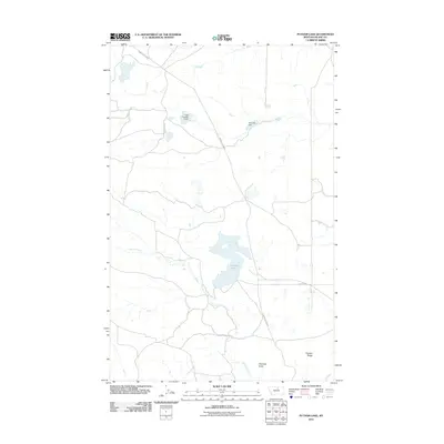
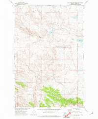
2011 Map of Putnam Lake
USGS Topo · Published 2011About this map
Putnam Lake and its surrounding high plains landscape in Blaine County define this northern Montana survey. The terrain is marked by significant topographic shifts, most notably at Haystack Butte and the elongated Putnam Ridge to the south. Water management in this semi-arid region is evident through the placement of the Tiger Number 2 Dam and the curiously named Olive Oil Dam, both of which capture seasonal flows in a network of drainage ways. The hydrology is further shaped by Suction Creek and Myrtle Creek, which meander across the prairie. Long, straight rural routes like Barney Olson Rd and Sand Cliff Rd provide the primary access to these remote ranching or agricultural lands, illustrating the vast, open-space settlement patterns of the 21st-century West.
Find a feature on this map
10 named features on this map. Tap any name to fly to it.
Don’t see what you’re looking for? This feature index may not catch every label — zoom into the map to look around manually.
Map Details
Editions of this 2011 Putnam Lake Map
This is the sole edition of this map. No revisions or reprints were ever made.
Other maps of this area

1953 · Havre
USGS Topo · 1:250,000

1956 · Rattlesnake
USGS Topo · 1:62,500

1956 · Cleveland
USGS Topo · 1:62,500

1957 · Havre
USGS Topo · 1:250,000

1958 · Havre
USGS Topo · 1:250,000

1971 · Putnam Lake
USGS Topo · 1:24,000
1971 · Fort Belknap Agency SE
USGS Topo · 1:24,000
1971 · Lake Seventeen NE
USGS Topo · 1:24,000
1971 · Lake Seventeen East
USGS Topo · 1:24,000
1971 · Lake Seventeen West
USGS Topo · 1:24,000