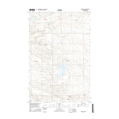
2017 Map of Putnam Lake
USGS Topo · Published 2017About this map
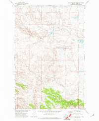
Putnam Lake and its surrounding drainage systems define this high-plains landscape in Blaine County. The terrain is marked by prominent landforms such as Haystack Butte and the long stretch of Putnam Ridge in the southern portion of the sheet. Water movement through this arid environment is tracked via several intermittent drainages, including Saint Johns Coulee in the north and the winding paths of Suction Cr and Myrtle Cr. A sparse network of unpaved corridors, such as Barney Olson Rd and Sand Cliff Rd, provides the primary access across the township and range divisions. The map reveals a land structured by its relief and seasonal watercourses, where names like Jacks Coulee and Left Fork Snake Butte Rd point to the local geography of North Central Montana.
Find a feature on this map
17 named features on this map. Tap any name to fly to it.
Don’t see what you’re looking for? This feature index may not catch every label — zoom into the map to look around manually.
Map Details
Editions of this 2017 Putnam Lake Map
This is the sole edition of this map. No revisions or reprints were ever made.
Other maps of this area

1953 · Havre
USGS Topo · 1:250,000

1956 · Rattlesnake
USGS Topo · 1:62,500

1956 · Cleveland
USGS Topo · 1:62,500

1957 · Havre
USGS Topo · 1:250,000

1958 · Havre
USGS Topo · 1:250,000

1971 · Putnam Lake
USGS Topo · 1:24,000
1971 · Fort Belknap Agency SE
USGS Topo · 1:24,000
1971 · Lake Seventeen NE
USGS Topo · 1:24,000
1971 · Lake Seventeen East
USGS Topo · 1:24,000
1971 · Lake Seventeen West
USGS Topo · 1:24,000