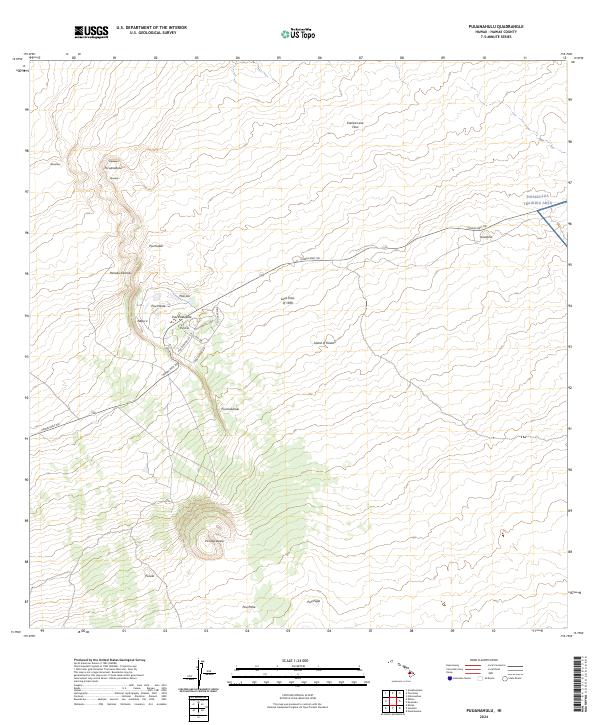
2024 Map of Puuanahulu
USGS Topo · Published 2024About this map
Pu'uanahulu and its neighboring settlements like Ahinahina and Mauiloa sit perched among the expansive volcanic fields of northwestern Hawaii. The landscape is dominated by historical geological events, most notably the wide-reaching Lava Flow of 1859 and the Kanikū Lava Flow to the north. These massive flows dictate the movement of modern infrastructure, with the Hawaii Belt Rd snaking across the blackened terrain to connect local residential loops like Puu Lani Dr and Puu Kamanu Ln. To the south, the prominent cinder cone of Pu'u'awa'awa'a rises sharply, while the eastern edge of the quadrangle transitions into the restricted zones of the Pohakuloa Training Area. The map illustrates a unique pattern of recent human habitation, where residential enclaves are carved directly into the ancient volcanic slopes of the Island of Hawai'i.
Find a feature on this map
27 named features on this map. Tap any name to fly to it.
Don’t see what you’re looking for? This feature index may not catch every label — zoom into the map to look around manually.
Map Details
Editions of this 2024 Puuanahulu Map
This is the sole edition of this map. No revisions or reprints were ever made.
Other maps of this area

1927 · Kaohe
USGS Topo · 1:62,500

1928 · Puako
USGS Topo · 1:62,500

1928 · Kailua
USGS Topo · 1:62,500

1930 · Kaohe
USGS Topo · 1:62,500

1954 · Hawaii North
USGS Topo · 1:250,000

1956 · Puu Hinai
USGS Topo · 1:24,000

1956 · Keamuku
USGS Topo · 1:24,000

1956 · Nohonaohae
USGS Topo · 1:24,000

1956 · Naohueleelua
USGS Topo · 1:24,000

1959 · Hawaii North
USGS Topo · 1:250,000