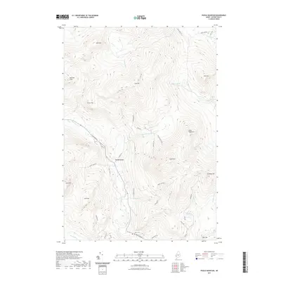
2021 Map of Puzzle Mountain
USGS Topo · Published 2021About this map
North Newry serves as a small human footprint in a landscape dominated by the high-elevation terrain of Oxford County. The Bear River winds through the valley floor, flanked by massive granite features including Puzzle Mtn and Lightning Ledge. This modern survey illustrates the persistent isolation of these mountain peaks, where naming conventions like Dresser Mtn and Plumbago Mtn hint at the local history of land use and mineral extraction. Toward the south, Powers Cem provides a specific point of interest for genealogists tracing families who settled in the shadow of Bald Mtn. The map also details numerous small watercourses such as Wight Brook and Chase Hill Brook, which define the drainage patterns of this high-relief area.
Find a feature on this map
48 named features on this map. Tap any name to fly to it.
Don’t see what you’re looking for? This feature index may not catch every label — zoom into the map to look around manually.
Map Details
Editions of this 2021 Puzzle Mountain Map
This is the sole edition of this map. No revisions or reprints were ever made.
Other maps of this area

1911 · Bryant Pond
USGS Topo · 1:62,500

1914 · Bethel
USGS Topo · 1:62,500

1914 · Bryant Pond
USGS Topo · 1:62,500

1927 · Rumford
USGS Topo · 1:48,000

1930 · Rumford
USGS Topo · 1:62,500

1940 · Bethel
USGS Topo · 1:62,500

1941 · Bethel
USGS Topo · 1:62,500

1942 · Bryant Pond
USGS Topo · 1:62,500

1943 · Old Speck Mtn
USGS Topo · 1:62,500

1945 · Old Speck Mtn
USGS Topo · 1:62,500