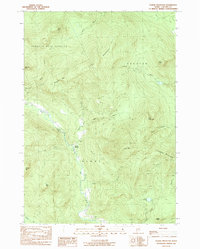
1984 Map of Puzzle Mountain
USGS Topo · Published 1985About this map
North Newry sits at the heart of this mountainous landscape in the mid-1980s, where the Bear River winds through narrow valleys between high peaks. This area of Oxford County is defined by its significant relief, featuring Puzzle Mtn and Plumbago Mountain to the east and the high ridgeline of Long Mountain to the north. The settlement pattern is sparse, concentrated primarily along the river corridor and the route of State Highway 26, reflecting the timber and mountain-focused economy of the era.
Find a feature on this map
32 named features on this map. Tap any name to fly to it.
Don’t see what you’re looking for? This feature index may not catch every label — zoom into the map to look around manually.
Map Details
Editions of this 1984 Puzzle Mountain Map
This is the sole edition of this map. No revisions or reprints were ever made.
Other maps of this area

1911 · Bryant Pond
USGS Topo · 1:62,500

1914 · Bethel
USGS Topo · 1:62,500

1914 · Bryant Pond
USGS Topo · 1:62,500

1927 · Rumford
USGS Topo · 1:48,000

1930 · Rumford
USGS Topo · 1:62,500

1940 · Bethel
USGS Topo · 1:62,500

1941 · Bethel
USGS Topo · 1:62,500

1942 · Bryant Pond
USGS Topo · 1:62,500

1943 · Old Speck Mtn
USGS Topo · 1:62,500

1945 · Old Speck Mtn
USGS Topo · 1:62,500