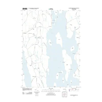
2012 Map of Quabbin Reservoir
USGS Topo · Published 2012About this map
The Quabbin Reservoir dominates this landscape, its waters surrounding numerous landforms that were once ridges and hills before the valley was flooded. The Prescott Peninsula stretches southward into the reservoir, containing the remains of old road networks and former community centers like Prescott Center and North Prescott. High points such as Packard Mountain and Prescott Hill overlook the water, while several islands like Mount Zion, Carrick Island, and Leveau Island mark where higher terrain remains above the current shoreline. To the west, the village of Cooleyville sits near the edge of the reservoir basin. Historical traces are visible in the placement of the Mountain View Cem and the route of the Monson Turnpike Rd. The topography is defined by significant landmarks such as The Gorge and Hamilton Orchards, illustrating the region's transition from agricultural and transit-oriented land to a major managed watershed.
Find a feature on this map
77 named features on this map. Tap any name to fly to it.
Don’t see what you’re looking for? This feature index may not catch every label — zoom into the map to look around manually.
Map Details
Editions of this 2012 Quabbin Reservoir Map
This is the sole edition of this map. No revisions or reprints were ever made.
Other maps of this area

1887 · Warwick
USGS Topo · 1:62,500

1887 · Belchertown
USGS Topo · 1:62,500

1887 · Winchendon
USGS Topo · 1:62,500

1887 · Barre
USGS Topo · 1:62,500

1889 · Barre
USGS Topo · 1:62,500

1889 · Warwick
USGS Topo · 1:62,500

1890 · Belchertown
USGS Topo · 1:62,500

1890 · Winchendon
USGS Topo · 1:62,500

1893 · Belchertown
USGS Topo · 1:62,500

1894 · Winchendon
USGS Topo · 1:62,500