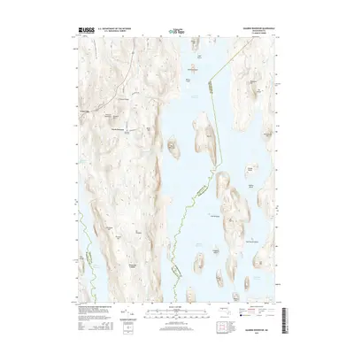
2015 Map of Quabbin Reservoir
USGS Topo · Published 2015About this map
Quabbin Reservoir dominates the landscape in this 2015 study, its waters surrounding a series of high ridges and isolated islands that were once part of the vibrant towns of the Swift River Valley. The Prescott Peninsula remains a prominent landform, home to the sites of North Prescott and Prescott Center, and the Mountain View Cem. Topographical detail reveals the complex geography of the reservoir, from the deep waters of The Gorge to the heights of Mt Zion and Soapstone Hill. On the western edge, the New England National Scenic Trail winds through the hills near Cooleyville, while the eastern shore is marked by the West Branch Fever Brook. This modern survey provides a clear view of the protected watershed, detailing the named peaks and islands like Carrick Island and Snell Island that define this unique interior Massachusetts wilderness.
Find a feature on this map
48 named features on this map. Tap any name to fly to it.
Don’t see what you’re looking for? This feature index may not catch every label — zoom into the map to look around manually.
Map Details
Editions of this 2015 Quabbin Reservoir Map
This is the sole edition of this map. No revisions or reprints were ever made.
Other maps of this area

1887 · Warwick
USGS Topo · 1:62,500

1887 · Belchertown
USGS Topo · 1:62,500

1887 · Winchendon
USGS Topo · 1:62,500

1887 · Barre
USGS Topo · 1:62,500

1889 · Barre
USGS Topo · 1:62,500

1889 · Warwick
USGS Topo · 1:62,500

1890 · Belchertown
USGS Topo · 1:62,500

1890 · Winchendon
USGS Topo · 1:62,500

1893 · Belchertown
USGS Topo · 1:62,500

1894 · Winchendon
USGS Topo · 1:62,500