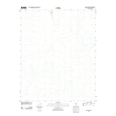
2012 Map of Quail Spring
USGS Topo · Published 2012About this map
Lost Lake sits in the northern desert landscape of San Bernardino County, a significant landmark in an area defined by its arid geography. This 2012 survey from the U.S. Geological Survey details the hydrological features of the Mojave, highlighting the vital presence of Quail Spring in the southwestern corner. The intricate drainage patterns shown on the map illustrate the complex network of ephemeral washes that shape this terrain during seasonal rains. As part of the National Geospatial Program, this document records the state of these natural water sources at the beginning of the decade, providing a clear picture of the land's topographical character without the influence of major road networks or human settlements.
Find a feature on this map
2 named features on this map. Tap any name to fly to it.
Don’t see what you’re looking for? This feature index may not catch every label — zoom into the map to look around manually.
Map Details
Editions of this 2012 Quail Spring Map
This is the sole edition of this map. No revisions or reprints were ever made.
Other maps of this area

1933 · Avawatz Mountains
USGS Topo · 1:250,000

1947 · Trona
USGS Topo · 1:250,000

1948 · Trona
USGS Topo · 1:250,000

1948 · Quail Mountains
USGS Topo · 1:62,500

1948 · Leach Lake
USGS Topo · 1:62,500

1950 · Wingate Wash
USGS Topo · 1:62,500

1950 · Confidence Hills
USGS Topo · 1:62,500

1951 · Quail Mountains
USGS Topo · 1:62,500
1951 · Leach Lake
USGS Topo · 1:62,500

1953 · Trona
USGS Topo · 1:250,000