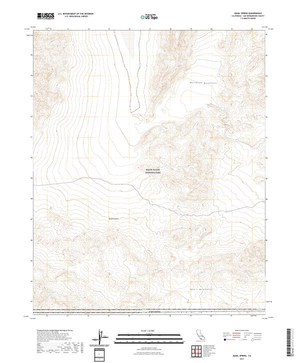
2021 Map of Quail Spring
USGS Topo · Published 2021About this map
Death Valley National Park and the northern boundary of Fort Irwin define this arid landscape in the Mojave Desert. The map highlights the intersection of protected wilderness and military training grounds, characterized by significant relief between the Owlshead Mountains to the north and the Quail Mountains to the south. Quail Spring serves as a critical water point in this high-desert environment, located near the base of its namesake range. The area is marked by complex topographic transitions and Public Land Survey System boundaries including t19n r1e and t18n r2e, illustrating the administrative partitioning of this remote section of San Bernardino County. Natural drainage patterns and dry washes dominate the terrain, reflecting the geological processes of the northern Mojave region.
Find a feature on this map
10 named features on this map. Tap any name to fly to it.
Don’t see what you’re looking for? This feature index may not catch every label — zoom into the map to look around manually.
Map Details
Editions of this 2021 Quail Spring Map
This is the sole edition of this map. No revisions or reprints were ever made.
Other maps of this area

1933 · Avawatz Mountains
USGS Topo · 1:250,000

1947 · Trona
USGS Topo · 1:250,000

1948 · Trona
USGS Topo · 1:250,000

1948 · Quail Mountains
USGS Topo · 1:62,500

1948 · Leach Lake
USGS Topo · 1:62,500

1950 · Wingate Wash
USGS Topo · 1:62,500

1950 · Confidence Hills
USGS Topo · 1:62,500

1951 · Quail Mountains
USGS Topo · 1:62,500
1951 · Leach Lake
USGS Topo · 1:62,500

1953 · Trona
USGS Topo · 1:250,000