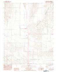
1984 Map of Quail Spring
USGS Topo · Published 1984About this map
The Quail Mountains and Owlshead Mountains converge in this arid portion of San Bernardino County, creating a landscape of extreme relief and seasonal water sources. The map identifies the remote Quail Spring and the ephemeral Lost Lake, critical landmarks for those navigating this desert terrain. Along the southern edge, the Fort Irwin Military Reservation Boundary marks the transition into restricted federal lands. Evidence of mining interests is present at a solitary Prospect, while numerous geodetic benchmarks, such as BM 2702, provide precise elevation data across the washes. This 1984 provisional edition captures the territory as it appeared following aerial photography in the late 1970s, documenting the unpopulated high desert before modern land use changes.
Find a feature on this map
12 named features on this map. Tap any name to fly to it.
Don’t see what you’re looking for? This feature index may not catch every label — zoom into the map to look around manually.
Map Details
Editions of this 1984 Quail Spring Map
This is the sole edition of this map. No revisions or reprints were ever made.
Other maps of this area

1933 · Avawatz Mountains
USGS Topo · 1:250,000

1947 · Trona
USGS Topo · 1:250,000

1948 · Trona
USGS Topo · 1:250,000

1948 · Quail Mountains
USGS Topo · 1:62,500

1948 · Leach Lake
USGS Topo · 1:62,500

1950 · Wingate Wash
USGS Topo · 1:62,500

1950 · Confidence Hills
USGS Topo · 1:62,500

1951 · Quail Mountains
USGS Topo · 1:62,500
1951 · Leach Lake
USGS Topo · 1:62,500

1953 · Trona
USGS Topo · 1:250,000