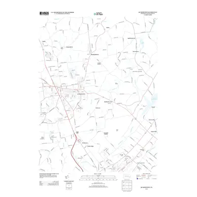
2013 Map of Quakertown
USGS Topo · Published 2013About this map
Quakertown serves as the central hub of this northern Bucks County landscape, where the street grid transitions into a dense network of suburban developments and rural crossroads. The area is defined by its water and historical crossings, with Tohickon Cr winding eastward toward the expansive Lake Nockamixon. The preservation of local heritage is evident in the presence of Sheards Mill Covered Bridge and Moods Covered Bridge, which mark longstanding transportation routes over the creeks. Smaller settlements like Richlandtown, Applebachsville, and Strawntown provide a view of the region's historic village character. Aviation interests are represented by multiple small facilities including Pennridge Airport and the Wicker & Wings Aerodrome, while the varied terrain of Rock Hill and the waters of Lake Towhee highlight the mix of recreational and residential land use in this part of Pennsylvania.
Find a feature on this map
243 named features on this map. Tap any name to fly to it.
Don’t see what you’re looking for? This feature index may not catch every label — zoom into the map to look around manually.
Map Details
Editions of this 2013 Quakertown Map
This is the sole edition of this map. No revisions or reprints were ever made.
Other maps of this area

1888 · Quakertown
USGS Topo · 1:62,500

1890 · Easton
USGS Topo · 1:62,500

1890 · Doylestown
USGS Topo · 1:62,500

1890 · Quakertown
USGS Topo · 1:62,500

1891 · Easton
USGS Topo · 1:62,500

1891 · Doylestown
USGS Topo · 1:62,500

1894 · Allentown
USGS Topo · 1:62,500

1894 · Quakertown
USGS Topo · 1:62,500

1932 · Easton
USGS Topo · 1:62,500

1939 · Allentown
USGS Topo · 1:62,500