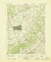
1943 Map of Quakertown
USGS Topo · Published 1943About this map
Quakertown serves as the dense urban hub of this 1943 survey, showing its gridded streets and early industrial footprint surrounded by a landscape of productive farmsteads and rural townships. The Reading railroad corridor provides the vital spine of the region, linking the borough to outlying settlements like Shelly in the north and the manufacturing center of Perkasie to the south. Small crossroad hamlets such as Loux Corner and Keelersville dot the countryside, illustrating the decentralized settlement pattern typical of upper Bucks County during the mid-twentieth century.
Find a feature on this map
43 named features on this map. Tap any name to fly to it.
Don’t see what you’re looking for? This feature index may not catch every label — zoom into the map to look around manually.
Map Details
Editions of this 1943 Quakertown Map
This is the sole edition of this map. No revisions or reprints were ever made.
Other maps of this area

1888 · Quakertown
USGS Topo · 1:62,500

1890 · Easton
USGS Topo · 1:62,500

1890 · Doylestown
USGS Topo · 1:62,500

1890 · Quakertown
USGS Topo · 1:62,500

1891 · Easton
USGS Topo · 1:62,500

1891 · Doylestown
USGS Topo · 1:62,500

1894 · Allentown
USGS Topo · 1:62,500

1894 · Quakertown
USGS Topo · 1:62,500

1932 · Easton
USGS Topo · 1:62,500

1939 · Allentown
USGS Topo · 1:62,500