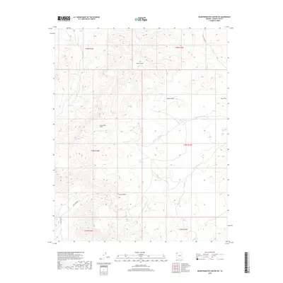
2018 Map of Quartermaster Canyon SW
USGS Topo · Published 2018About this map
The Grand Wash Cliffs dominate this arid landscape within the Mojave Desert, marking a sharp topographical transition. This region of Mohave County is characterized by isolated water sources essential for livestock and local travel, including Honeymoon Tank, Topside Reservoir, and Lost Cr Reservoir. The network of springs like Hillside Springs and Mud Spring suggests a reliance on small, reliable water points in a territory defined by canyons and washes. Movement through this portion of the Arizona desert is facilitated by scattered ranch roads such as Music Ranch Rd and Tenny Ranch Rd, which navigate the terrain around Hells Canyon and the broad Horse Flat. The drainage of Reference Point Cr and Lost Cr further illustrates the complex watershed system feeding this corner of the state.
Find a feature on this map
28 named features on this map. Tap any name to fly to it.
Don’t see what you’re looking for? This feature index may not catch every label — zoom into the map to look around manually.
Map Details
Editions of this 2018 Quartermaster Canyon SW Map
This is the sole edition of this map. No revisions or reprints were ever made.
Other maps of this area

1886 · Diamond Creek
USGS Topo · 1:250,000

1886 · Camp Mohave
USGS Topo · 1:250,000

1892 · Diamond Creek
USGS Topo · 1:250,000

1892 · Camp Mohave
USGS Topo · 1:250,000

1942 · Camp Mohave
USGS Topo · 1:250,000

1947 · Kingman
USGS Topo · 1:250,000

1948 · Kingman
USGS Topo · 1:250,000

1948 · Williams
USGS Topo · 1:250,000

1954 · Kingman
USGS Topo · 1:250,000

1954 · Williams
USGS Topo · 1:250,000