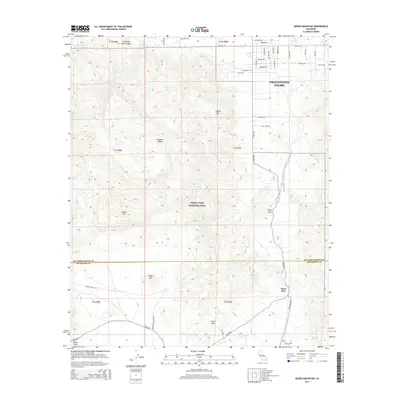
2015 Map of Queen Mountain
USGS Topo · Published 2015About this map
Joshua Tree National Park dominates this desert landscape, where the high peaks of the Mojave Desert meet the residential edge of Twentynine Palms. The map details a transition from suburban street grids, such as Wilshire Ave and Sunrise Dr, into the protected wilderness of the national park. Geographic landmarks like Queen Mountain and Joshua Mountain rise above the basin, while localized water sources like Pine Spring and the Fortynine Palms Oasis provide rare ecological relief in the arid terrain. The mapping of the Desert Queen Mine Rd and Pinto Wye highlights the intersection of early mining infrastructure with modern park access. Travelers and researchers can trace the boundary between San Bernardino and Riverside counties as it cuts through the center of the park, passing near Negro Hill and the Sheep Pass area.
Find a feature on this map
45 named features on this map. Tap any name to fly to it.
Don’t see what you’re looking for? This feature index may not catch every label — zoom into the map to look around manually.
Map Details
Editions of this 2015 Queen Mountain Map
This is the sole edition of this map. No revisions or reprints were ever made.
Other maps of this area

1942 · Amboy
USGS Topo · 1:250,000

1943 · Amboy
USGS Topo · 1:250,000

1943 · Pinkham Well
USGS Topo · 1:62,500

1944 · Pinkham Well
USGS Topo · 1:62,500

1944 · Pinyon Well
USGS Topo · 1:62,500

1947 · Santa Ana
USGS Topo · 1:250,000

1949 · Santa Ana
USGS Topo · 1:250,000

1953 · San Bernardino
USGS Topo · 1:250,000

1954 · Salton Sea
USGS Topo · 1:250,000

1954 · Needles
USGS Topo · 1:250,000