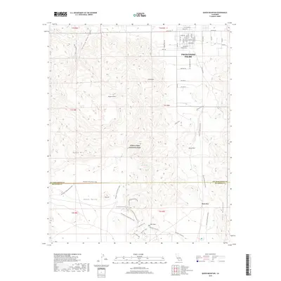
2018 Map of Queen Mountain
USGS Topo · Published 2018About this map
Twentynine Palms serves as the residential anchor on the northern edge of this desert landscape, where a dense grid of local streets like Bedouin Ave and Sahara Ave transitions into the protected wilderness of Joshua Tree National Park. The survey highlights a rugged transition from the residential desert valley to the high peaks of Queen Mtn and Joshua Mtn. Evidence of early 20th-century resource extraction remains visible at the Contact Mine, tucked into the rocky terrain northwest of Rocky Point.
Find a feature on this map
56 named features on this map. Tap any name to fly to it.
Don’t see what you’re looking for? This feature index may not catch every label — zoom into the map to look around manually.
Map Details
Editions of this 2018 Queen Mountain Map
This is the sole edition of this map. No revisions or reprints were ever made.
Other maps of this area

1942 · Amboy
USGS Topo · 1:250,000

1943 · Amboy
USGS Topo · 1:250,000

1943 · Pinkham Well
USGS Topo · 1:62,500

1944 · Pinkham Well
USGS Topo · 1:62,500

1944 · Pinyon Well
USGS Topo · 1:62,500

1947 · Santa Ana
USGS Topo · 1:250,000

1949 · Santa Ana
USGS Topo · 1:250,000

1953 · San Bernardino
USGS Topo · 1:250,000

1954 · Salton Sea
USGS Topo · 1:250,000

1954 · Needles
USGS Topo · 1:250,000