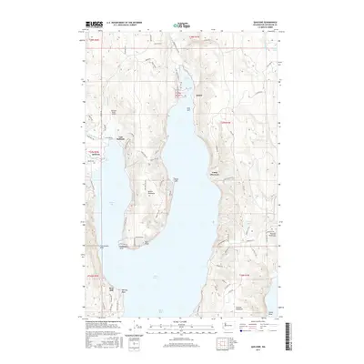
2017 Map of Quilcene
USGS Topo · Published 2017About this map
Quilcene and East Quilcene occupy the northwestern corner of this study, where the Little Quilcene River and Big Quilcene River empty into the northern reaches of the Hood Canal. The geography is dominated by the narrow inlets of Quilcene Bay and Dabob Bay, which isolate the Bolton Peninsula from the larger Toandos Peninsula to the east. This coastal landscape reveals a network of rural roads such as Dabob Rd and Coyle Rd that connect small settlements like Dabob and Bees Mill with the shoreline. Aviation and recreation are noted through the Kimshan Ranch Airport and Camp Discovery, while the interior terrain is marked by family-named landmarks and natural features like Silent Lake and the prominent Red Bluff. The mapping reflects a modern era of coastal settlement where timber and maritime access continue to shape the local infrastructure.
Find a feature on this map
76 named features on this map. Tap any name to fly to it.
Don’t see what you’re looking for? This feature index may not catch every label — zoom into the map to look around manually.
Map Details
Editions of this 2017 Quilcene Map
This is the sole edition of this map. No revisions or reprints were ever made.
Other maps of this area

1936 · Point Misery
USGS Topo · 1:62,500

1937 · Port Orchard
USGS Topo · 1:62,500

1937 · Port Gamble
USGS Topo · 1:62,500

1940 · Port Gamble
USGS Topo · 1:62,500

1940 · Point Misery
USGS Topo · 1:62,500

1940 · Quilcene
USGS Topo · 1:62,500

1953 · Seabeck
USGS Topo · 1:24,000

1953 · Poulsbo
USGS Topo · 1:24,000

1953 · Quilcene
USGS Topo · 1:24,000

1953 · Mt. Walker
USGS Topo · 1:24,000