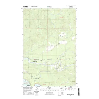
2017 Map of Quillayute Prairie
USGS Topo · Published 2017About this map
Quillayute Prairie and its smaller counterpart, Little Quillayute Prairie, define this coastal lowland where the Olympic Peninsula meets the Pacific Ocean. This landscape is characterized by the convergence of major waterways, including the Sol Duc River, Bogachiel River, and Dickey River, which merge to form the Quillayute River before reaching the coast. Local history is anchored by the settlement of Mora and the Quillayute Prairie Cem, while modern infrastructure is represented by the Quillayute Airport.
Find a feature on this map
57 named features on this map. Tap any name to fly to it.
Don’t see what you’re looking for? This feature index may not catch every label — zoom into the map to look around manually.
Map Details
Editions of this 2017 Quillayute Prairie Map
This is the sole edition of this map. No revisions or reprints were ever made.
Other maps of this area

1935 · Ozette Lake
USGS Topo · 1:62,500

1935 · Lake Pleasant
USGS Topo · 1:62,500

1939 · Forks
USGS Topo · 1:62,500

1942 · Ozette Lake
USGS Topo · 1:62,500

1942 · Lake Pleasant
USGS Topo · 1:62,500

1943 · Copalis Beach
USGS Topo · 1:250,000

1951 · Copalis Beach
USGS Topo · 1:250,000

1953 · Cape Flattery
USGS Topo · 1:250,000

1956 · La Push
USGS Topo · 1:62,500

1956 · Ozette Lake
USGS Topo · 1:62,500