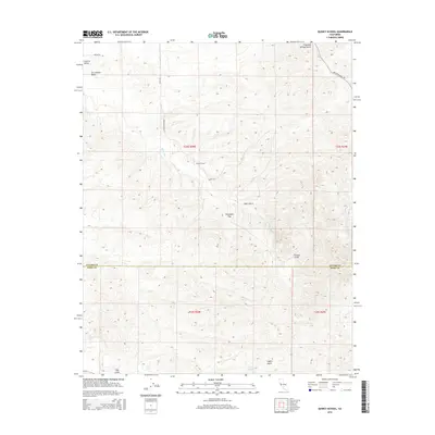
2015 Map of Quincy School
USGS Topo · Published 2015About this map
Quincy School stands as a central landmark in this landscape where the eastern San Joaquin Valley begins to transition into the rising foothills of the Sierra Nevada. The topography is defined by a series of southwest-trending drainage systems, including Fountain Springs Gulch, Tyler Gulch, and Grizzly Gulch, all carved into the terrain as they descend toward the valley floor. The White River winds through the center of the sheet, providing a primary hydrological corridor for this region on the Tulare and Kern County border.
Find a feature on this map
23 named features on this map. Tap any name to fly to it.
Don’t see what you’re looking for? This feature index may not catch every label — zoom into the map to look around manually.
Map Details
Editions of this 2015 Quincy School Map
This is the sole edition of this map. No revisions or reprints were ever made.
Other maps of this area

1926 · Quincy School
USGS Topo · 1:31,680

1929 · Richgrove
USGS Topo · 1:31,680

1929 · Quincy School
USGS Topo · 1:31,680

1929 · Ducor
USGS Topo · 1:31,680

1931 · Deepwell Ranch
USGS Topo · 1:31,680

1932 · Woody
USGS Topo · 1:62,500

1935 · Woody
USGS Topo · 1:62,500

1936 · White River
USGS Topo · 1:62,500

1936 · Tobias Peak
USGS Topo · 1:125,000
1942 · Slater
USGS Topo · 1:62,500