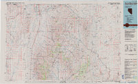
1985 Map of Quinn River Valley
USGS Topo · Published 1985About this map
The Quinn River Valley defines this high-desert corridor along the Nevada-Oregon border, where the Quinn River flows through a landscape marked by isolated ranching outposts and high-altitude mining claims. In the northern reaches, the McDermitt settlement sits adjacent to the Fort Mc Dermitt Indian Reservation, serving as a vital hub where Highway 95 crosses from Humboldt County into Oregon. To the south, the valley widens near Orovada and the road to Paradise Valley, a region where the transition from the arid valley floor to the timbered slopes of the Humboldt National Forest is most pronounced.
Find a feature on this map
54 named features on this map. Tap any name to fly to it.
Don’t see what you’re looking for? This feature index may not catch every label — zoom into the map to look around manually.
Map Details
Editions of this 1985 Quinn River Valley Map
This is the sole edition of this map. No revisions or reprints were ever made.
Other maps of this area

1882 · Paradise
USGS Topo · 1:250,000

1886 · Disaster
USGS Topo · 1:250,000

1893 · Paradise
USGS Topo · 1:250,000

1893 · Disaster
USGS Topo · 1:250,000
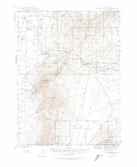
1945 · Hot Springs
USGS Topo · 1:62,500
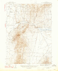
1947 · Hot Springs Peak
USGS Topo · 1:62,500

1954 · Vya
USGS Topo · 1:250,000

1955 · McDermitt
USGS Topo · 1:250,000

1955 · Jordan Valley
USGS Topo · 1:250,000

1955 · Adel
USGS Topo · 1:250,000