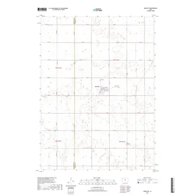
2018 Map of Radcliffe
USGS Topo · Published 2018About this map
Radcliffe serves as the central hub of this agricultural landscape along the western border of Hardin County. The town's grid is clearly defined by local streets such as Isabella St, Catherine St, and E Minnie St, with a Post Office and Drake Airport located on its eastern outskirts. This survey captures a rural environment deeply rooted in its local heritage, evidenced by the numerous burial grounds scattered throughout the surrounding townships. These include Radcliffe Cem north of town, Bethany Cem in the northwest, and Concord Township Cem in the southeast. The terrain is drained by several small watercourses, including Honey Cr to the north, Bear Cr to the west, and Minerva Cr flowing through the southern portion of the quadrangle. The map also delineates the precise boundary between Hamilton and Hardin counties, marked by Zublin Ave.
Find a feature on this map
48 named features on this map. Tap any name to fly to it.
Don’t see what you’re looking for? This feature index may not catch every label — zoom into the map to look around manually.
Map Details
Editions of this 2018 Radcliffe Map
This is the sole edition of this map. No revisions or reprints were ever made.
Other maps of this area

1912 · Ames
USGS Topo · 1:62,500

1914 · Ames
USGS Topo · 1:62,500

1954 · Waterloo
USGS Topo · 1:250,000

1955 · Waterloo
USGS Topo · 1:250,000

1975 · Story City
USGS Topo · 1:24,000

1975 · Zearing
USGS Topo · 1:24,000

1975 · Mc Callsburg
USGS Topo · 1:24,000

1978 · Ellsworth
USGS Topo · 1:24,000

1978 · Williams
USGS Topo · 1:24,000

1979 · Buckeye West
USGS Topo · 1:24,000