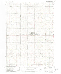
1979 Map of Radcliffe
USGS Topo · Published 1980About this map
Radcliffe serves as the central hub of this Iowa landscape, where the Chicago and North Western railroad line intersects with local commerce and recreation at the Radcliffe Golf Course. The map illustrates a strictly organized rural grid system across Lincoln and Sherman townships, revealing a pattern of agricultural land use interspersed with vital community landmarks. To the east, the Chicago Rock Island and Pacific tracks run north toward the small settlement of Sherman. This 1970s survey captures a transition in local infrastructure, featuring the Drake Airport and a prominent Radio Tower alongside traditional markers like Salem Ch and the Bethany Cem. The drainage of the land is defined by the winding paths of Honey Creek and Minerva Creek, while several modern Pipelines cross the southern sections near Scott and Concord townships.
Find a feature on this map
23 named features on this map. Tap any name to fly to it.
Don’t see what you’re looking for? This feature index may not catch every label — zoom into the map to look around manually.
Map Details
Editions of this 1979 Radcliffe Map
This is the sole edition of this map. No revisions or reprints were ever made.
Other maps of this area

1912 · Ames
USGS Topo · 1:62,500

1914 · Ames
USGS Topo · 1:62,500

1954 · Waterloo
USGS Topo · 1:250,000

1955 · Waterloo
USGS Topo · 1:250,000

1975 · Story City
USGS Topo · 1:24,000

1975 · Zearing
USGS Topo · 1:24,000

1975 · Mc Callsburg
USGS Topo · 1:24,000

1978 · Ellsworth
USGS Topo · 1:24,000

1978 · Williams
USGS Topo · 1:24,000

1979 · Buckeye West
USGS Topo · 1:24,000