2022 Map of Raeford
USGS Topo · Published 2022About this map
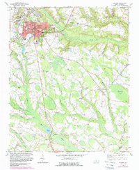
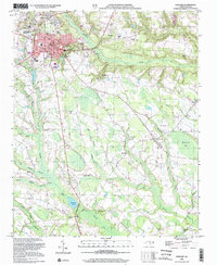
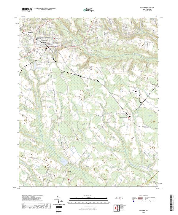
The Hoke County Courthouse stands as the central landmark of Raeford, the heart of this coastal plain landscape. The geography is defined by an intricate network of slow-moving water, where Raft Swamp and Big Marsh Swamp dominate the southern half of the quadrangle. These wetlands are punctuated by smaller settlements like Antioch and Gold Hill, which sit at the intersection of rural routes and natural drainage systems. To the north, the town of Raeford shows a structured grid of residential streets such as Cumberland Ave and Stevens St, transitioning into the suburban character of Hillcrest and Silver City. Historically significant water features like McNeils Mill Cr and Williamson Pond hint at the local water-driven industry that once shaped these rural communities. The border between Hoke Co and Robeson Co cuts through the southern reaches, marking the political boundary amidst the dense hydrology of Big Middle Swamp.
Find a feature on this map
159 named features on this map. Tap any name to fly to it.
Don’t see what you’re looking for? This feature index may not catch every label — zoom into the map to look around manually.
Map Details
Editions of this 2022 Raeford Map
This is the sole edition of this map. No revisions or reprints were ever made.
Historical Maps of Arabia Through Time
4 maps found