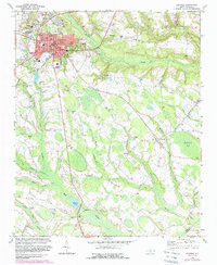
1972 Map of Raeford
USGS Topo · Published 1988About this map
Raeford serves as the primary hub of this landscape, its urban grid defined by the Aberdeen and Rockfish RR and a cluster of civic institutions including the Courthouse, Town Hall, and several educational sites like County High Sch. The surrounding Hoke County terrain is characterized by an intricate drainage system of swamps and creeks, most notably the winding Big Marsh Swamp and Rockfish Creek.
Find a feature on this map
50 named features on this map. Tap any name to fly to it.
Don’t see what you’re looking for? This feature index may not catch every label — zoom into the map to look around manually.
Map Details
Editions of this 1972 Raeford Map
3 editions found
Other maps of this area

1948 · Southern Pines
USGS Topo · 1:62,500

1948 · Clifdale
USGS Topo · 1:62,500

1948 · Nicholson Creek
USGS Topo · 1:24,000

1948 · Clifdale
USGS Topo · 1:24,000

1948 · Mc Cain
USGS Topo · 1:24,000

1949 · Wagram
USGS Topo · 1:24,000

1949 · Wakulla
USGS Topo · 1:24,000

1949 · Laurinburg
USGS Topo · 1:62,500

1950 · Clifdale
USGS Topo · 1:24,000

1950 · Sanatorium
USGS Topo · 1:24,000