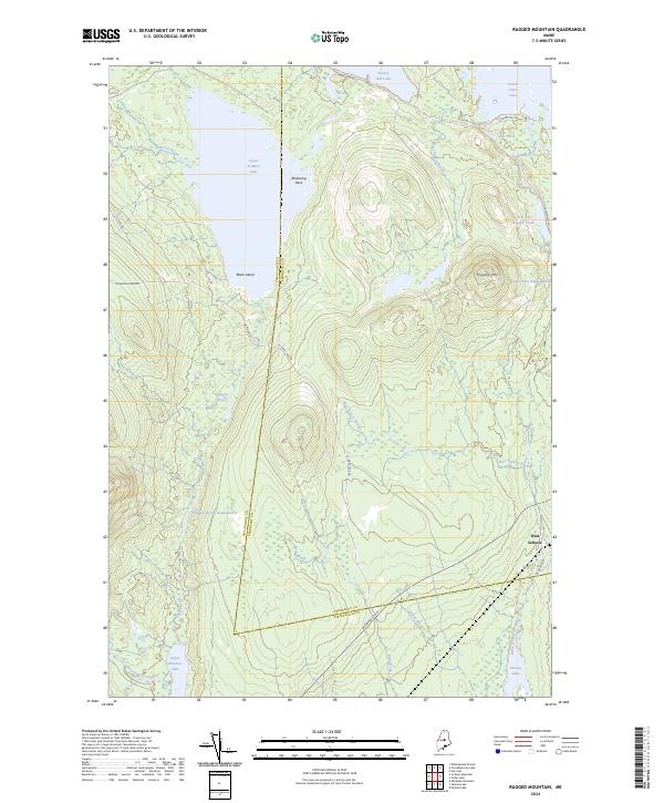
2024 Map of Ragged Mountain
USGS Topo · Published 2024About this map
Ragged Mtn stands as the central landmark in this portion of the Maine north woods, where the boundary between Piscataquis and Penobscot counties bisects a landscape of interconnected water systems. The map detail shows an intricate network of timber-access routes like Jo-Mary Lake Rd and Brownville Rd, which navigate the terrain between significant water bodies such as Upper Jo-Mary Lake and Seboeis Lake. Notable geological and hydrologic features include Balancing Rock and the Wangan Brook Deadwater, reflecting the glacial legacy of the region. This modern survey documents the contemporary state of the wilderness near West Seboeis, capturing the current footprint of the logging roads and the seasonal drainage patterns of the East Branch Pleasant River and West Seboeis Stream.
Find a feature on this map
31 named features on this map. Tap any name to fly to it.
Don’t see what you’re looking for? This feature index may not catch every label — zoom into the map to look around manually.
Map Details
Editions of this 2024 Ragged Mountain Map
This is the sole edition of this map. No revisions or reprints were ever made.
Other maps of this area

1940 · Sebec
USGS Topo · 1:48,000

1943 · Sebec
USGS Topo · 1:62,500

1947 · Schoodic
USGS Topo · 1:62,500

1949 · Schoodic
USGS Topo · 1:62,500

1951 · Norcross
USGS Topo · 1:62,500

1952 · Jo-Mary Mountain
USGS Topo · 1:62,500

1954 · Millinocket
USGS Topo · 1:250,000

1958 · Millinocket
USGS Topo · 1:250,000

1960 · Millinocket
USGS Topo · 1:250,000
1978 · Norcross
USGS Topo · 1:24,000