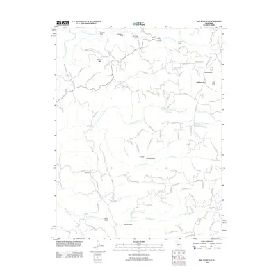
2012 Map of Rail Road Flat
USGS Topo · Published 2012About this map
Alabama Hill rises above a complex landscape of drainages and small settlements in Calaveras County. This 2012 survey details the historic community of Rail Road Flat and the neighboring hamlet of Glencoe, areas defined by their proximity to the Middle Fork Mokelumne River and the N Fork Calaveras River. Local infrastructure like the Calaveras Public Utility Ditch and Number 5 Ditch Rd trace the path of historical water management and mining legacy, while family-named routes such as Norwich Mine Rd and Baugh Rd highlight the regional transit network.
Find a feature on this map
101 named features on this map. Tap any name to fly to it.
Don’t see what you’re looking for? This feature index may not catch every label — zoom into the map to look around manually.
Map Details
Editions of this 2012 Rail Road Flat Map
This is the sole edition of this map. No revisions or reprints were ever made.
Other maps of this area

1889 · Jackson
USGS Topo · 1:125,000

1891 · Big Trees
USGS Topo · 1:125,000

1892 · Jackson
USGS Topo · 1:125,000

1894 · Big Trees
USGS Topo · 1:125,000

1897 · Jackson
USGS Topo · 1:125,000

1897 · Big Trees
USGS Topo · 1:125,000

1901 · Big Trees
USGS Topo · 1:125,000

1902 · Jackson
USGS Topo · 1:125,000

1945 · San Andreas
USGS Topo · 1:62,500

1947 · San Andreas
USGS Topo · 1:62,500