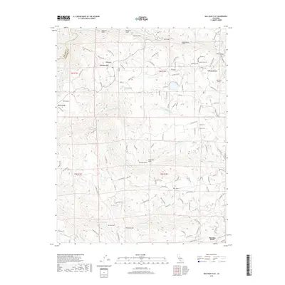
2018 Map of Rail Road Flat
USGS Topo · Published 2018About this map
Alabama Hill and the adjacent settlement of Glencoe anchor the northwestern reaches of this terrain, where the Mokelumne River and its various forks carve deep drainages through the landscape. The map reveals a region defined by its gold-country heritage and rural connectivity, with a dense network of naming conventions tied to local geography, such as Valentine Gulch and Humbug Gulch. The industrial history of Calaveras County is centered on the Wolverine Mine near Independence, while logistical roots are preserved in labels like Wells Fargo Station Rd and Railroad Flat Rd. Water management is evident through features like Number 5 Ditch Rd, Clark Reservoir, and the N Fork Calaveras River, illustrating how water was channeled for local needs. Small clusters of habitation at Mountain Ranch and Rich Gulch demonstrate the scattered settlement patterns typical of this portion of the Sierra foothills.
Find a feature on this map
111 named features on this map. Tap any name to fly to it.
Don’t see what you’re looking for? This feature index may not catch every label — zoom into the map to look around manually.
Map Details
Editions of this 2018 Rail Road Flat Map
This is the sole edition of this map. No revisions or reprints were ever made.
Other maps of this area

1889 · Jackson
USGS Topo · 1:125,000

1891 · Big Trees
USGS Topo · 1:125,000

1892 · Jackson
USGS Topo · 1:125,000

1894 · Big Trees
USGS Topo · 1:125,000

1897 · Jackson
USGS Topo · 1:125,000

1897 · Big Trees
USGS Topo · 1:125,000

1901 · Big Trees
USGS Topo · 1:125,000

1902 · Jackson
USGS Topo · 1:125,000

1945 · San Andreas
USGS Topo · 1:62,500

1947 · San Andreas
USGS Topo · 1:62,500