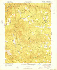
1949 Map of Railroad Flat
USGS Topo · Published 1949About this map
Railroad Flat and Glencoe anchor this survey of the Sierra Nevada foothills shortly after the Second World War. The landscape is defined by the deep incisions of the Middle Fork Mokelumne River and the North Fork Calaveras River, which carved the gold-bearing canyons that drove the region's 19th-century boom. Evidence of this persistent mineral interest remains visible through numerous claims, including the Etna Mine, Wolverine Mine, and the Jeff Davis Mine near Independence.
Find a feature on this map
39 named features on this map. Tap any name to fly to it.
Don’t see what you’re looking for? This feature index may not catch every label — zoom into the map to look around manually.
Map Details
Editions of this 1949 Railroad Flat Map
This is the sole edition of this map. No revisions or reprints were ever made.
Other maps of this area

1889 · Jackson
USGS Topo · 1:125,000

1891 · Big Trees
USGS Topo · 1:125,000

1892 · Jackson
USGS Topo · 1:125,000

1894 · Big Trees
USGS Topo · 1:125,000

1897 · Jackson
USGS Topo · 1:125,000

1897 · Big Trees
USGS Topo · 1:125,000

1901 · Big Trees
USGS Topo · 1:125,000

1902 · Jackson
USGS Topo · 1:125,000

1945 · San Andreas
USGS Topo · 1:62,500

1947 · San Andreas
USGS Topo · 1:62,500