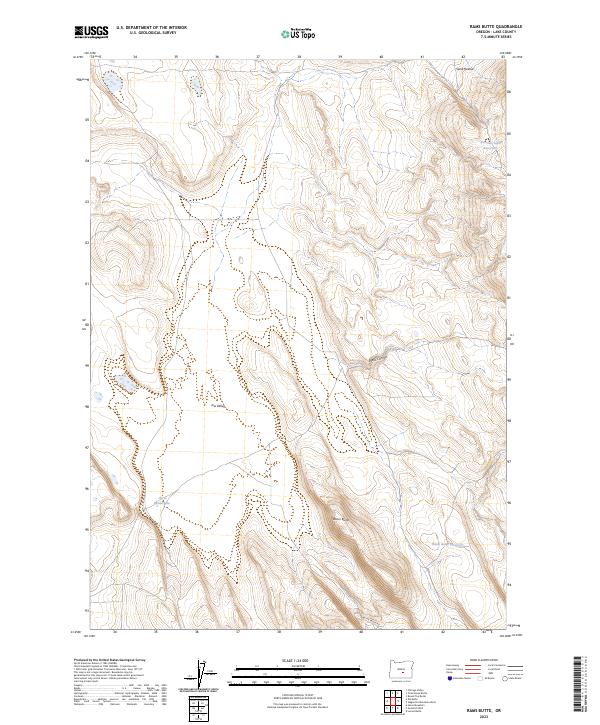
2023 Map of Rams Butte
USGS Topo · Published 2023About this map
Rams Butte rises as a prominent landmark in this high-desert portion of Lake County, where water management is the primary signal of human activity in an otherwise sparse landscape. The presence of features such as Burrows Lake Reservoir and Rams Butte Reservoir, alongside the Curve Waterhole, indicates the critical importance of localized catchments for livestock and wildlife in this arid region. The topography is defined by the broad Jew Valley and the sharp incision of Black Canyon, which directs seasonal runoff toward the lower basins. Modern transportation is limited to the lonely stretch of Butte Valley Rd in the southern portion of the quadrangle. This 2023 survey provides a clear look at how the Public Land Survey System (PLSS) divides the territory into townships like t26s r22e, a framework essential for understanding modern land ownership and historical grazing allotments.
Find a feature on this map
14 named features on this map. Tap any name to fly to it.
Don’t see what you’re looking for? This feature index may not catch every label — zoom into the map to look around manually.
Map Details
Editions of this 2023 Rams Butte Map
This is the sole edition of this map. No revisions or reprints were ever made.
Other maps of this area

1955 · Crescent
USGS Topo · 1:250,000

1955 · Burns
USGS Topo · 1:250,000

1957 · Crescent
USGS Topo · 1:250,000

1958 · Crescent
USGS Topo · 1:250,000

1958 · Burns
USGS Topo · 1:250,000

1959 · Burns
USGS Topo · 1:250,000

1970 · Crescent
USGS Topo · 1:250,000

1980 · Wagontire Mtn West
USGS Topo · 1:24,000

1980 · Round Top Butte
USGS Topo · 1:24,000
1981 · Tired Horse Butte
USGS Topo · 1:24,000