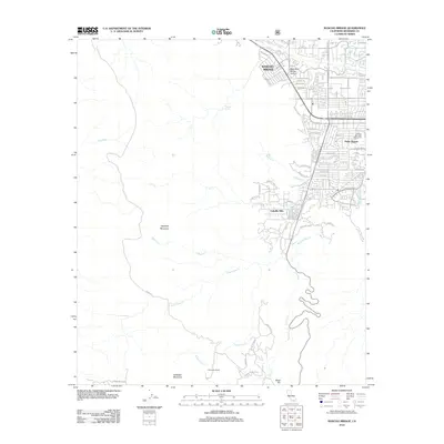
2012 Map of Rancho Mirage
USGS Topo · Published 2012About this map
The Rancho Mirage and Palm Desert corridor transitions abruptly from organized desert resort life to the untamed wilderness of the San Jacinto and Santa Rosa mountains. This 2012 survey illustrates the sharp edge of development where residential streets like Sahara Rd and Magnesia Falls Dr terminate against the steep drainage of Magnesia Spring Canyon. To the south, the landscape is defined by remote peaks and water sources including Asbestos Mountain, Haystack Mountain, and Potrero Spring, providing a detailed look at the drainage patterns of Dead Indian Cr and Carrizo Cr. The map captures the suburban footprint of Cahuilla Hills and established leisure landmarks such as the Shadow Mountain Golf Course, while preserving the location of older landmarks like the Shumway Ranch in the high desert terrain.
Find a feature on this map
54 named features on this map. Tap any name to fly to it.
Don’t see what you’re looking for? This feature index may not catch every label — zoom into the map to look around manually.
Map Details
Editions of this 2012 Rancho Mirage Map
This is the sole edition of this map. No revisions or reprints were ever made.
Other maps of this area

1901 · Southern California Sheet No. 1
USGS Topo · 1:250,000

1901 · San Jacinto
USGS Topo · 1:125,000

1904 · Indio
USGS Topo · 1:125,000

1904 · Southern California Sheet No. 1
USGS Topo · 1:250,000

1940 · Palm Springs
USGS Topo · 1:62,500

1940 · Hemet Reservoir
USGS Topo · 1:62,500

1941 · Toro Peak
USGS Topo · 1:62,500

1941 · Edom
USGS Topo · 1:62,500

1942 · Hemet Reservoir
USGS Topo · 1:62,500

1944 · Toro peak
USGS Topo · 1:62,500