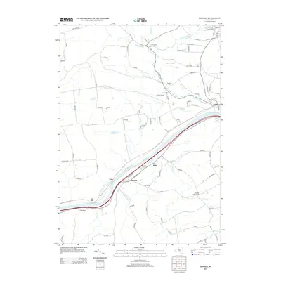
2013 Map of Randall
USGS Topo · Published 2013About this map
The Mohawk River corridor dominates this map, carving a path between the distinctive heights of Big Nose and Little Nose. This valley serves as a critical transportation artery, hosting major infrastructure alongside the river's winding course near the settlement of Yosts. The landscape north of the river transitions into a mix of orchards and family-run agricultural operations, including Sand Flats Orchard, Appleridge Farm, and B and B Crop Farms. Several small communities and historic points are scattered across the terrain, notably Sammonsville and Berryville. For genealogists, the map identifies local burial sites such as Sammons Cem, Evergreen Cem, and Nestle Cem. The prominent landform of Stone Ridge overlooks the hamlet of Randall, illustrating the tight relationship between the region's geography and its historic settlements and roadway networks.
Find a feature on this map
106 named features on this map. Tap any name to fly to it.
Don’t see what you’re looking for? This feature index may not catch every label — zoom into the map to look around manually.
Map Details
Editions of this 2013 Randall Map
This is the sole edition of this map. No revisions or reprints were ever made.
Other maps of this area

1896 · Fonda
USGS Topo · 1:62,500

1898 · Fonda
USGS Topo · 1:62,500

1898 · Canajoharie
USGS Topo · 1:62,500

1900 · Canajoharie
USGS Topo · 1:62,500

1901 · Lassellsville
USGS Topo · 1:62,500

1902 · Canajoharie
USGS Topo · 1:62,500

1902 · Fonda
USGS Topo · 1:62,500

1903 · Gloversville
USGS Topo · 1:62,500

1903 · Lassellsville
USGS Topo · 1:62,500

1943 · Gloversville
USGS Topo · 1:62,500