2023 Map of Randlett
USGS Topo · Published 2023About this map
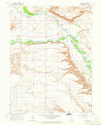
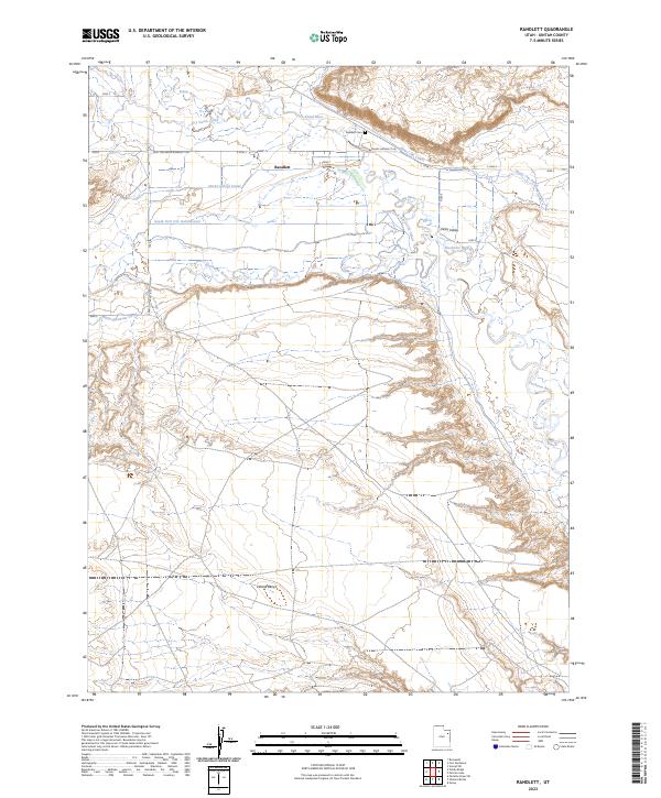
Randlett serves as the central hub of this Uintah County landscape, situated at the convergence of several significant water systems in the Uinta Valley. The settlement pattern is defined by its proximity to the Uinta River and the Duchesne River, which dominate the central and eastern portions of the quadrangle. An intricate network of irrigation infrastructure is visible, including the Henry Jim Canal, Ouray School Canal, and South Fork Dry Gulch Canal, illustrating the region's managed water resources. To the south, the terrain transitions into the elevated Leland Bench, while local history is anchored by the Randlett Cem located just north of the primary township. The map also traces established travel routes such as the Fort Duchesne-Randlett Rd and the Ouray-Randlett Rd, which connect the settlement to the surrounding valley.
Find a feature on this map
13 named features on this map. Tap any name to fly to it.
Don’t see what you’re looking for? This feature index may not catch every label — zoom into the map to look around manually.
Map Details
Editions of this 2023 Randlett Map
This is the sole edition of this map. No revisions or reprints were ever made.