Old Maps of Uintah County, Utah
Explore 254 old maps of Uintah County, spanning from 1885 to today. These high-resolution historic maps reveal how streets, neighborhoods, landmarks, and natural features evolved over time — perfect for genealogy, metal detecting, research, and local history exploration.
What you can do with these maps:
- See how Uintah County changed over time: Compare historical maps to modern-day views to trace roads, homesites, rail lines & more.
- View detailed metadata: Each map includes creators, publishers, year, scale, and archive source.
- Overlay maps with satellite & LiDAR: Visualize the past alongside modern tools to explore terrain & human change.
- Trusted historical sources: Maps sourced from the USGS, Library of Congress, and other archives.
- Access maps your way: View online, download high-res files, or order prints for personal or research use.
Start exploring old maps of Uintah County to uncover forgotten places, hidden landmarks, and the deep history beneath your feet.
Uintah County, UT maps
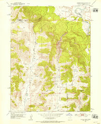
(254)- 1885 Map of East Tavaputs
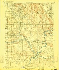
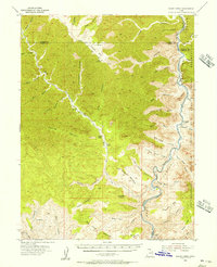
 1885 East Tavaputs1885 Print · USGSEastern Utah in the mid-1880s was a landscape of massive plateaus and vital rail corridors. Researchers can trace the path of the Denver and Rio Grande Western through the Grand River Valley or locate water sources like Asphalt Creek and Bitter Water Creek.6 unique versions available
 - 1885 Map of Ashley
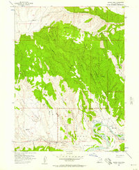
 1885 Ashley1885 Print · USGSThe Uinta Basin in the mid-1880s was a landscape defined by the winding Green River and the high peaks of the eastern Uintas. Researchers can trace early outposts like White Rocks and settlements such as Ashley and Ouray.5 unique versions available
 - 1886 Map of Price River
 1886 Price River1886 Print · USGSEmery County and the surrounding canyonlands are documented here just as the railroad arrived in the mid-1880s. Local researchers can trace the early path of the Denver and Rio Grande Western R. R. through Castle Gate, Price, and Sunny Side.4 unique versions available
 - 1896 Map of Price River
 1896 Price River1896 Print · USGSEmery County was transitioning into a vital rail corridor during the late nineteenth century. Trace the early layout of Price and Castle Dale alongside the winding Denver and Rio Grande Western RR and the depths of Desolation Canyon.
 - 1906 Map of Marsh Peak
 1906 Marsh Peak1906 Print · USGSThe Uinta Mountains and the winding Green River corridor come alive in this survey from the early 1900s. Genealogists and historians can trace the foundations of high-country industry at Dyer Mine or locate early outposts like Dodds Cabin and Manila.2 unique versions available
 - 1907 Map of Jensen, 1957 Print
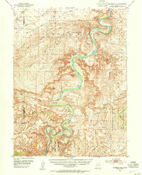
 1907 Jensen1957 Print · USGSEastern Utah and the Colorado borderlands are shown here at the turn of the century as a frontier of river crossings and ranching outposts. Trace the early Stage Road to Dragon or locate the historic Ferry at Jensen near Dinosaur National Monument.
 - 1908 Map of Marsh Peak
 1908 Marsh Peak1908 Print · USGSThe high Uinta wilderness along the Utah and Wyoming border is captured here during the first decade of the 1900s. Researchers can trace early industry and remote dwellings such as the Dyer Mine, Johnsons Mill, and Dodds Cabin.2 unique versions available
 - 1910 Map of Jensen
 1910 Jensen1910 Print · USGSThe Utah-Colorado borderlands come alive in the first decade of the twentieth century, showing the early development of the Uinta Basin. Genealogists and historians can locate early river crossings at the ferry sites near Jensen or trace the road to Dragon Stage Road.2 unique versions available
 - 1917 Map of Vernal
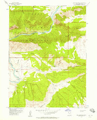
 1917 Vernal1917 Print · USGSThe Uinta Basin during the early twentieth century shows a landscape defined by river confluences and emerging irrigation benches. Genealogists can trace family names at Leota Ranch, explore the vicinity of Fort Duchesne, or locate rural schools like Bennett School.2 unique versions available
 - 1950 Map of Burnt Cabin Gorge, 1952 Print
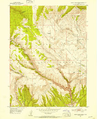 1950 Burnt Cabin Gorge1952 Print · USGSThe high Uinta backcountry of 1950 shows a working landscape of stock reservoirs and deep canyons. Trace the history of high-country ranching at the Diamond Counting Corral or explore the rugged depths of Burnt Cabin Gorge.2 unique versions available
 - 1950 Map of Blair Basin, 1952 Print
 1950 Blair Basin1952 Print · USGSUintah County ranching life is preserved in the early fifties, showing the high-country homesteads of the Diamond Mountain Plateau. Genealogists and historians can trace family operations at the Carl Searle Ranch, Willis Ranch, and Goodrich Ranch.2 unique versions available
 - 1950 Map of Dyer Mountain, 1952 Print
 1950 Dyer Mountain1952 Print · USGSUintah County's high-country mining and forest management are captured here during the early fifties. Researchers can locate the historic Bullionville (Site), trace the Government Ditch, and explore the area around the Dyer Mines.3 unique versions available
 - 1952 Map of Warren Draw, 1953 Print
 1952 Warren Draw1953 Print · USGSThe high Uinta Mountains and the winding Green River meet in this early 1950s survey of the Daggett and Uintah county line. Researchers can locate critical water sources and high-altitude crossings like Spitzenberg Spring, Dead Horse Pass, and Felix Pass.2 unique versions available
 - 1953 Map of Nutters Hole, 1954 Print
 1953 Nutters Hole1954 Print · USGSThe Green River backcountry of eastern Utah is shown here in the early 1950s before modern infrastructure changed the reach of the basin. Genealogists and historians can locate the Sand Wash Ferry (Site) and trace the boundaries of the Uintah and Ouray Indian Reservation.3 unique versions available
 - 1953 Map of Firewater Canyon, 1955 Print
 1953 Firewater Canyon1955 Print · USGSThe Green River flows through the remote canyons of Uintah County in the early 1950s, documenting a time of isolation in the Uintah and Ouray Indian Reservation. Researchers can trace old routes and water sources like Tabyago Spring, School Section Canyon, and Rock House Bottom.3 unique versions available
 - 1954 Map of Flat Canyon, 1956 Print
 1954 Flat Canyon1956 Print · USGSThe high plateau country of Carbon and Uintah counties is documented here in the mid-fifties, dominated by the winding course of the Green River. Researchers can trace the remote Rock Creek Ranch and locate early energy infrastructure like the isolated Gas Well on Cedar Ridge.2 unique versions available
 - 1954 Map of Range Creek, 1956 Print
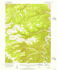
 1954 Range Creek1956 Print · USGSEastern Utah in the mid-fifties remains a world of remote cattle outposts and deep river gorges. Researchers can trace the isolated Pilling Ranch and Wilcox Ranch along Range Creek, or follow the winding Green River through the heart of Desolation Canyon.3 unique versions available
 - 1954 Map of Vernal, 1966 Print
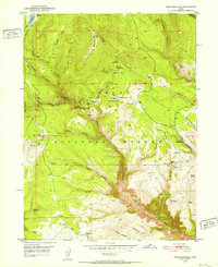
 1954 Vernal1966 Print · USGSThe Green River basin and Uinta Mountains come alive in this mid-century survey of northeastern Utah and northwestern Colorado. Genealogists and researchers can trace the development of remote outposts like Little Bonanza, Artesia, and Dutch John alongside the expanding Flaming Gorge Reservoir.4 unique versions available
 - 1955 Map of Island Park, 1957 Print
 1955 Island Park1957 Print · USGSThe Green River backcountry of Uintah County is captured here in the mid-fifties, showing the intersection of ranching and federal conservation. Genealogists and historians can trace Ruple Ranch and landmarks like Bobby Ford and Diamond Mountain.3 unique versions available
 - 1955 Map of Stuntz Reservoir, 1957 Print
 1955 Stuntz Reservoir1957 Print · USGSThe Utah-Colorado borderlands come alive in the mid-1950s, showing a remote landscape of high ridges and isolated ranching outposts. Genealogists and historians can trace family-named sites like the Chew Ranch, Harland Cabin, and the winding Daniels Trail.2 unique versions available
 - 1955 Map of Jones Hole, 1957 Print
 1955 Jones Hole1957 Print · USGSThe Utah-Colorado borderlands appear in the mid-1950s as a remote landscape of canyons and high plateaus. Researchers can trace the early trails and outposts of Dinosaur National Monument, including Snow Ranch, Chew Ranch, and the Jones Hole Ranger Station.4 unique versions available
 - 1955 Map of Split Mountain, 1957 Print
 1955 Split Mountain1957 Print · USGSThe Green River and its challenging whitewater rapids define this mid-fifties landscape in Uintah County. Researchers can trace the legacy of remote ranching life at Morris Ranch and Daniels Ranch or follow the path of the Daniels Trail.2 unique versions available
 - 1956 Map of Price, 1968 Print
 1956 Price1968 Print · USGSCentral Utah in the mid-fifties showcases a landscape shaped by coal mining and mountain-fed irrigation. Trace the rail-and-river economy through the Geneva Coal Mine, the Union Pacific line, and settlements like Price and Ephraim.3 unique versions available
 - 1956 Map of Grand Junction, 1973 Print
 1956 Grand Junction1973 Print · USGSThe Grand Valley and its surrounding high plateaus are captured here in the mid-twentieth century as the region's ranching and rail heritage remained central. Researchers can trace the path of the Denver & Rio Grande Western RR through Grand Junction or locate remote outposts like Dragon and Atchee.2 unique versions available
 - 1958 Map of Vernal
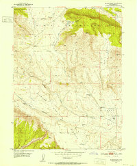
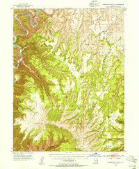
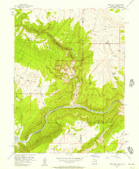
 1958 Vernal1958 Print · USGSThe Uinta Basin at the end of the fifties reveals a landscape shaped by massive river systems and burgeoning energy interests. Researchers can trace the layout of Uintah and Ouray Indian Reservation lands and industrial sites like the Gilsonite coking plant and Bonanza.
Showing maps 1-25 of 254
Top cities of Uintah County
Frequently asked questions
- What are the different types of historical maps available for Uintah County?
- What is the oldest map of Uintah County?
- Where can I purchase historical maps of Uintah County for my home or office?
- Where can I download high-res historical maps of Uintah County?
- Are there historical topographic maps available for Uintah County?
- Is there historical aerial imagery available for Uintah County?
- Where are historical maps of Uintah County sourced from?