1970s Maps of Uintah County, Utah
Explore 4 historic maps of Uintah County from the 1970s. These maps offer a rare glimpse into what life looked like during the 1970s — showing old roads, neighborhoods, homes, and landmarks that have changed or disappeared over time.
Whether you're researching your family's past, planning a metal detecting trip, or studying how Uintah County's landscape evolved across the 1970s, these high-resolution maps are a powerful tool for exploring the history of this region.
- Focus on a specific era: All maps on this page are from the 1970s, giving you a focused view of this time period.
- See what’s changed: Compare century-old streets, trails, and buildings to today's modern landscape using overlays and satellite layers.
- Research with precision: Use these maps for genealogy, historical research, land use analysis, or educational projects.
- View, download, or print: Maps are fully viewable online in high resolution, and can be downloaded or printed for your own records.
Start exploring Uintah County's history through authentic maps from the 1970s. This is your window into the past.
Uintah County, UT maps
(4)- 1970 Map of Cedar Camp Canyon, 1973 Print
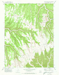 1970 Cedar Camp Canyon1973 Print · USGSThe high plateau of the Uintah and Grand County line is captured here in the early seventies during a period of active energy exploration. Researchers can trace the remote operations at the Gas Field and locate isolated landmarks like the Tomlinson Ranch or the Three Pines overlook.3 unique versions available
 - 1970 Map of P R Spring, 1973 Print
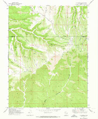 1970 P R Spring1973 Print · USGSThe high plateau on the Uintah and Grand County line in the early seventies shows a landscape where remote ranching met the growing energy industry. Researchers can trace early energy infrastructure through the Gas Field and find legacy landmarks like Tomlinson Ranch and P R Spring.2 unique versions available
 - 1970 Map of San Arroyo Ridge, 1973 Print
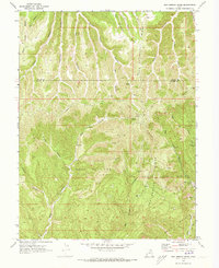 1970 San Arroyo Ridge1973 Print · USGSGrand and Uintah Counties are shown during a period of intense energy development in the early seventies. Researchers can trace the sprawling network of the San Arroyo Gas Field and locate the remote San Arroyo Camp near the Taylor Canyon Trail.2 unique versions available
 - 1970 Map of Jim Canyon, 1973 Print
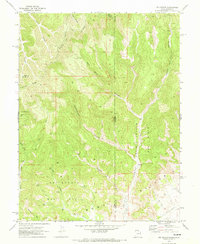 1970 Jim Canyon1973 Print · USGSThe Utah-Colorado borderlands come alive in this early 1970s survey of the high desert and energy country. Local historians and researchers can trace the development of the San Arroyo Gas Field and remote routes like the Jeep Trail through Jim Canyon.2 unique versions available
End of results
Showing maps 1-4 of 4
Top cities of Uintah County
Frequently asked questions
- What are the different types of historical maps available for Uintah County?
- What is the oldest map of Uintah County?
- Where can I purchase historical maps of Uintah County for my home or office?
- Where can I download high-res historical maps of Uintah County?
- Are there historical topographic maps available for Uintah County?
- Is there historical aerial imagery available for Uintah County?
- Where are historical maps of Uintah County sourced from?