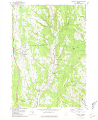
1981 Map of Randolph Center
USGS Topo · Published 1981About this map
Randolph Center serves as a local hub atop the ridge in the late 1970s, anchored by the campus of Vermont Technical College and its adjacent Athletic Field. The landscape is defined by the steep descent from these heights into the valley of the Second Branch White River, where a string of smaller villages—North Randolph, East Randolph, and South Randolph—follow the water's edge. This settlement pattern reflects the traditional Vermont reliance on river valleys for transit and industry, while the uplands remained dedicated to institutional and agricultural use.
Find a feature on this map
48 named features on this map. Tap any name to fly to it.
Don’t see what you’re looking for? This feature index may not catch every label — zoom into the map to look around manually.
Map Details
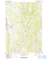
Editions of this 1981 Randolph Center Map
2 editions found
Other maps of this area

1896 · Strafford
USGS Topo · 1:62,500

1919 · Royalton
USGS Topo · 1:62,500

1922 · Barre
USGS Topo · 1:48,000

1924 · Barre
USGS Topo · 1:62,500

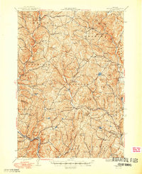
1924 · Randolph
USGS Topo · 1:48,000

1926 · Randolph
USGS Topo · 1:62,500
1944 · Strafford
USGS Topo · 1:62,500

1947 · Corinth
USGS Topo · 1:62,500

1948 · East Barre
USGS Topo · 1:62,500

1950 · Glens Falls
USGS Topo · 1:250,000