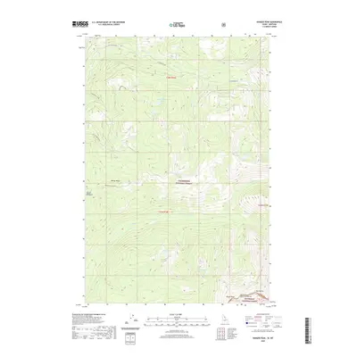
2020 Map of Ranger Peak
USGS Topo · Published 2020About this map
Ranger Peak stands as the primary landmark in this remote corner of the Bitterroot National Forest, straddling the high-elevation divide between Idaho and Montana. The landscape is defined by its complex drainage systems, where the headwaters of Brushy Fork and Storm Creek carve deep through the mountain terrain. Historically significant for its forest service management and recreational geography, the area contains numerous alpine water bodies including Rudd-Moore Lakes, Beaver Lake, and the remote Spruce Cr Lakes. The map highlights the transition between the Bitterroot and the Clearwater National Forest, marked by the prominent Beaver Ridge. Further south, the peak at Old Stormy overlooks a network of creeks like Shoot Cr and Tuan Cr, illustrating the rugged, unpopulated character of the Continental Divide backcountry in the early 21st century.
Find a feature on this map
28 named features on this map. Tap any name to fly to it.
Don’t see what you’re looking for? This feature index may not catch every label — zoom into the map to look around manually.
Map Details
Editions of this 2020 Ranger Peak Map
This is the sole edition of this map. No revisions or reprints were ever made.
Other maps of this area

1901 · Hamilton
USGS Topo · 1:125,000

1911 · Lolo
USGS Topo · 1:250,000

1912 · Missoula
USGS Topo · 1:125,000

1913 · Lolo
USGS Topo · 1:250,000

1956 · Hamilton
USGS Topo · 1:250,000

1959 · Hamilton
USGS Topo · 1:250,000

1960 · Hamilton
USGS Topo · 1:250,000

1964 · Hamilton
USGS Topo · 1:250,000

1964 · Lolo Hot Springs
USGS Topo · 1:24,000

1964 · Dick Creek
USGS Topo · 1:24,000