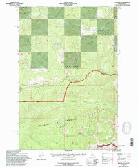
1994 Map of Ranger Peak
USGS Topo · Published 1997About this map
Beaver Ridge Lookout stands as a sentinel over this high-elevation landscape along the border of Idaho Co and Ravalli Co. This 1994 revision captures a primitive and protected expanse where the Clearwater National Forest meets the Bitterroot National Forest, divided by the prominent Beaver Ridge. The map details the transition into the Selway Bitterroot Wilderness, marked by a network of drainage basins including Brushy Fork and Shoot Creek. Numerous alpine water bodies such as Siah Lake, Ranger Lake, and the Rudd Moore Lakes are scattered across the high basins. Human activity is limited to a few specific corridors, most notably an Electronic Site near the summit of Ranger Peak and the remote access provided by the Powell Rd and Stevensville Rd.
Find a feature on this map
26 named features on this map. Tap any name to fly to it.
Don’t see what you’re looking for? This feature index may not catch every label — zoom into the map to look around manually.
Map Details
Editions of this 1994 Ranger Peak Map
This is the sole edition of this map. No revisions or reprints were ever made.
Other maps of this area

1901 · Hamilton
USGS Topo · 1:125,000

1911 · Lolo
USGS Topo · 1:250,000

1912 · Missoula
USGS Topo · 1:125,000

1913 · Lolo
USGS Topo · 1:250,000

1956 · Hamilton
USGS Topo · 1:250,000

1959 · Hamilton
USGS Topo · 1:250,000

1960 · Hamilton
USGS Topo · 1:250,000

1964 · Hamilton
USGS Topo · 1:250,000

1964 · Lolo Hot Springs
USGS Topo · 1:24,000

1964 · Dick Creek
USGS Topo · 1:24,000