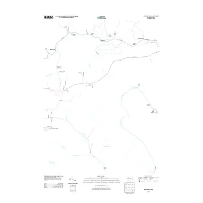
2013 Map of Rathbun
USGS Topo · Published 2013About this map
Rathbun and Swissmont anchor this 2013 survey of Elk County, Pennsylvania, showing a landscape defined by deep drainages and isolated settlements. The geography is characterized by an extensive system of named hollows, including Schoolhouse Hollow, Friddle Hollow, and Steinhopper Hollow, which feed into major watercourses like West Cr and Big Run. The mapping reveals the transition from wilder terrain to the infrastructure supporting St Marys Municipal Airport in the south, while names like Hellfire Run and Sawdust Run hint at the area's logging and industrial heritage. Transportation is channeled through the narrow valleys, with W Creek Rd and the Bucktail Trl following the contours of the land. High points like Goetz Summit provide the necessary topographic contrast to the numerous creek beds that have dictated the placement of roads and homesteads for generations.
Find a feature on this map
57 named features on this map. Tap any name to fly to it.
Don’t see what you’re looking for? This feature index may not catch every label — zoom into the map to look around manually.
Map Details
Editions of this 2013 Rathbun Map
This is the sole edition of this map. No revisions or reprints were ever made.
Other maps of this area

1935 · Mt. Jewett
USGS Topo · 1:48,000

1940 · Mt. Jewett
USGS Topo · 1:62,500

1941 · Benezette
USGS Topo · 1:62,500

1941 · Ridgway
USGS Topo · 1:62,500

1943 · Benezette
USGS Topo · 1:62,500

1944 · Ridgway
USGS Topo · 1:62,500

1948 · Crosby
USGS Topo · 1:62,500

1948 · Wildwood Fire Tower
USGS Topo · 1:24,000

1948 · Rich Valley
USGS Topo · 1:24,000
1950 · Rich Valley
USGS Topo · 1:24,000