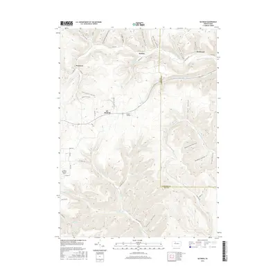
2016 Map of Rathbun
USGS Topo · Published 2016About this map
St. Marys and the rural settlements of Elk County characterize this landscape during the mid-2010s. The topography is defined by a dense network of drainages and named hollows, such as Beechwood Hollow and Schoolhouse Hollow, which dictate the placement of local infrastructure. Small communities like Rathbun and Swissmont are situated along the winding corridors of West Creek and its various forks, reflecting the historical reliance on these narrow valley floors for transport and habitation in this part of Pennsylvania.
Find a feature on this map
54 named features on this map. Tap any name to fly to it.
Don’t see what you’re looking for? This feature index may not catch every label — zoom into the map to look around manually.
Map Details
Editions of this 2016 Rathbun Map
This is the sole edition of this map. No revisions or reprints were ever made.
Other maps of this area

1935 · Mt. Jewett
USGS Topo · 1:48,000

1940 · Mt. Jewett
USGS Topo · 1:62,500

1941 · Benezette
USGS Topo · 1:62,500

1941 · Ridgway
USGS Topo · 1:62,500

1943 · Benezette
USGS Topo · 1:62,500

1944 · Ridgway
USGS Topo · 1:62,500

1948 · Crosby
USGS Topo · 1:62,500

1948 · Wildwood Fire Tower
USGS Topo · 1:24,000

1948 · Rich Valley
USGS Topo · 1:24,000
1950 · Rich Valley
USGS Topo · 1:24,000