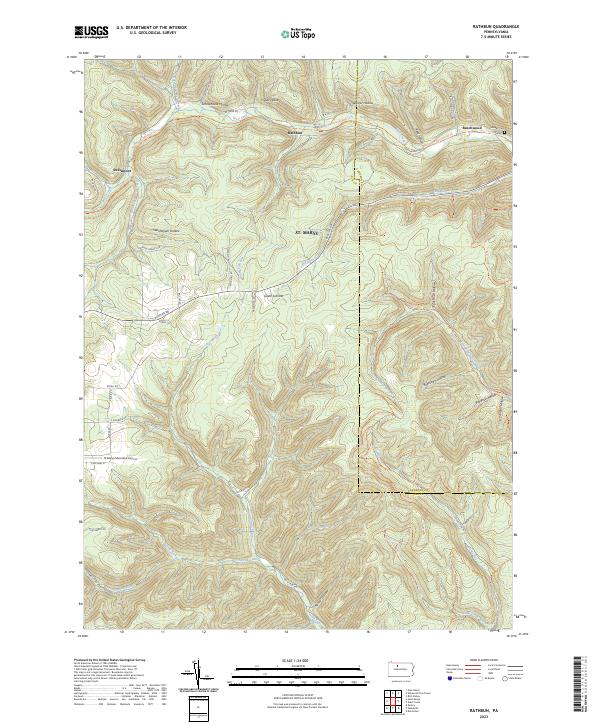
2023 Map of Rathbun
USGS Topo · Published 2023About this map
St. Marys extends its reach into the rugged plateau of the Elk County and Cameron County border, where the deep incisions of West Creek and its tributaries define the landscape. Small rail-side settlements like Rathbun and Beechwood cling to the narrow valley floor along W Creek Rd, while the uplands are marked by numerous named drainages such as Friddle Hollow and Warner Hollow. The presence of the St Marys Municipal Airport on the high ground near S Michael St contrasts with the remote character of the surrounding timbered ridges.
Find a feature on this map
60 named features on this map. Tap any name to fly to it.
Don’t see what you’re looking for? This feature index may not catch every label — zoom into the map to look around manually.
Map Details
Editions of this 2023 Rathbun Map
This is the sole edition of this map. No revisions or reprints were ever made.
Other maps of this area

1935 · Mt. Jewett
USGS Topo · 1:48,000

1940 · Mt. Jewett
USGS Topo · 1:62,500

1941 · Benezette
USGS Topo · 1:62,500

1941 · Ridgway
USGS Topo · 1:62,500

1943 · Benezette
USGS Topo · 1:62,500

1944 · Ridgway
USGS Topo · 1:62,500

1948 · Crosby
USGS Topo · 1:62,500

1948 · Wildwood Fire Tower
USGS Topo · 1:24,000

1948 · Rich Valley
USGS Topo · 1:24,000
1950 · Rich Valley
USGS Topo · 1:24,000