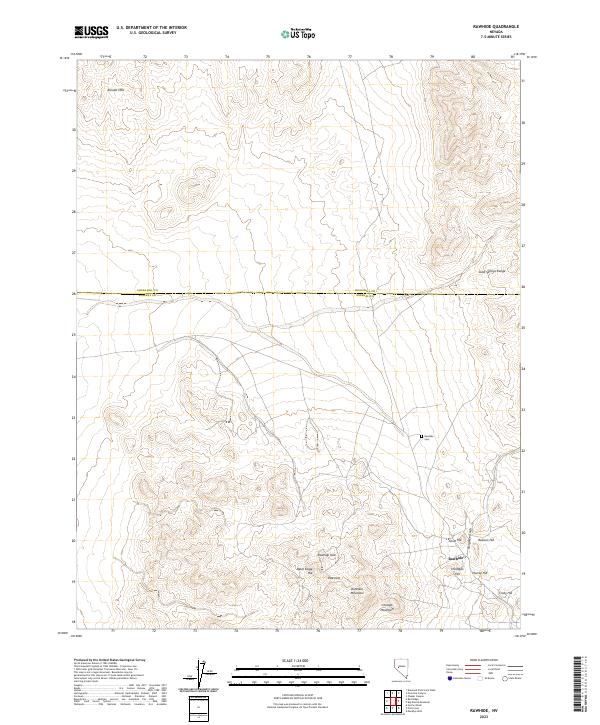
2023 Map of Rawhide
USGS Topo · Published 2023About this map
The Rawhide settlement and its surrounding hills dominate this landscape along the boundary of Churchill and Mineral Counties. This area is defined by its mining-era legacy, where the topography is dotted with family-named peaks and industrial landmarks. The cluster of elevations including Hooligan Hill, Balloon Hill, and Murray Hill suggests a dense concentration of early 20th-century activity, while the presence of the Rawhide Cem nearby serves as a quiet reminder of the community that once thrived in this arid environment.
Find a feature on this map
25 named features on this map. Tap any name to fly to it.
Don’t see what you’re looking for? This feature index may not catch every label — zoom into the map to look around manually.
Map Details
Editions of this 2023 Rawhide Map
This is the sole edition of this map. No revisions or reprints were ever made.
Other maps of this area

1908 · Carson Sink
USGS Topo · 1:250,000

1909 · Hawthorne
USGS Topo · 1:250,000

1910 · Carson Sink
USGS Topo · 1:250,000

1911 · Hawthorne
USGS Topo · 1:250,000

1915 · Hawthorne
USGS Topo · 1:250,000

1948 · Walker Lake
USGS Topo · 1:250,000

1951 · Allen Springs
USGS Topo · 1:62,500

1957 · Walker Lake
USGS Topo · 1:250,000

1957 · Reno
USGS Topo · 1:250,000

1959 · Reno
USGS Topo · 1:250,000